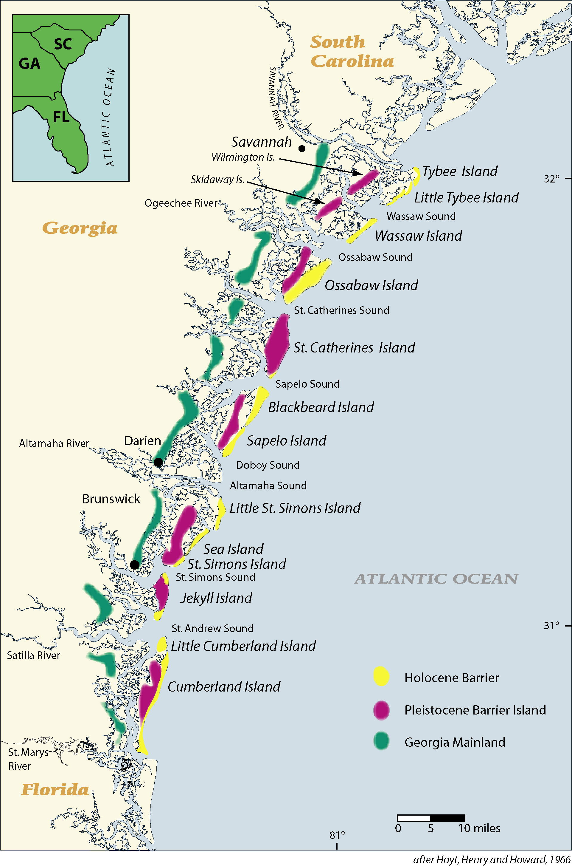
Barrier islands, also known as the Golden Isles, line the coast of Georgia. The Lower Coastal Plain extends for sixty-five to seventy miles between the Savannah and St. Marys rivers and contains the remains of older and higher shorelines west of the present coast. Previously occupied by Native Americans, today these ancient shorelines support the cities of Savannah, Darien, and Brunswick.
The New Georgia Encyclopedia does not hold the copyright for this media resource and can neither grant nor deny permission to republish or reproduce the image online or in print. All requests for permission to publish or reproduce the resource must be submitted to the rights holder.