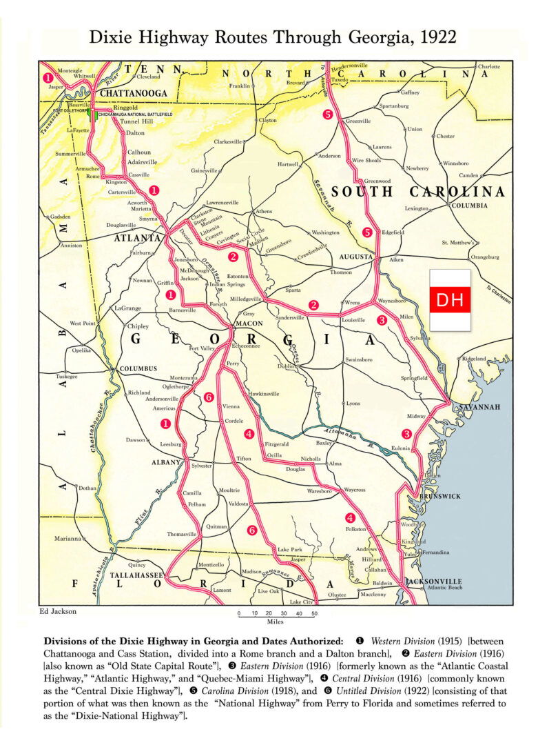
Dixie Highway Map, 1922
Linked to Dixie Highway
- Details
- Terms of Use
Divisions of the Dixie Highway in Georgia and Dates Authorized: (1) Western Division (1915)—between Chattanooga and Cassville, divided into a Rome branch and a Dalton branch; (2) Eastern Division (1916)—also known as "Old State Capital Route"; (3) Eastern Division (1916)—formerly known as the "Atlantic Coastal Highway," "Atlantic Highway," and "Quebec-Miami Highway"; (4) Central Division (1916)—commonly known as the "Central Dixie Highway"; (5) Carolina Division (1918); and (6) Untitled Division (1922)—consisting of that portion of what was then known as the "National Highway" from Perry to Florida and sometimes referred to as the "Dixie-National Highway."See full-size map.
Courtesy of Edwin L. Jackson
The New Georgia Encyclopedia does not hold the copyright for this media resource and can neither grant nor deny permission to republish or reproduce the image online or in print. All requests for permission to publish or reproduce the resource must be submitted to the rights holder.


