The New Georgia Encyclopedia is supported by funding from A More Perfect Union, a special initiative of the National Endowment for the Humanities.
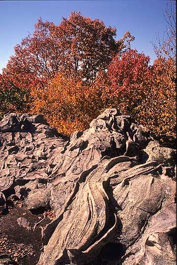
Strata of nonmarine sediments are pictured just across the state line in Phenix City, Alabama. Alternating layers of marine and nonmarine rock formations in the Coastal Plain reveal that long-term fluctuations in sea level occurred in Georgia throughout the Late Cretaceous period.
Photograph by Pamela J. W. Gore
The New Georgia Encyclopedia does not hold the copyright for this media resource and can neither grant nor deny permission to republish or reproduce the image online or in print. All requests for permission to publish or reproduce the resource must be submitted to the rights holder.
One end of Georgia's fall line, which marks the boundary between the hard rocks of the Piedmont geologic province and the softer rocks of the Coastal Plain, is located in Columbus. Marked by waterfalls and rapids, the fall line stretches across the state to Augusta.
Photograph by Pamela J. W. Gore
The New Georgia Encyclopedia does not hold the copyright for this media resource and can neither grant nor deny permission to republish or reproduce the image online or in print. All requests for permission to publish or reproduce the resource must be submitted to the rights holder.
High Falls is located along the fall line at High Falls State Park in Butts County. The fall line crosses the state from Augusta to Columbus and marks the point at which the hard rocks of the Piedmont meet the softer rocks of the Coastal Plain.
Image from Stephen Rahn
The New Georgia Encyclopedia does not hold the copyright for this media resource and can neither grant nor deny permission to republish or reproduce the image online or in print. All requests for permission to publish or reproduce the resource must be submitted to the rights holder.
Georgia encompasses parts of five distinct geographic regions: the Appalachian Plateau, the Valley and Ridge, the Blue Ridge, the Piedmont, and the Coastal Plain.
Courtesy of Pamela J. W. Gore
The New Georgia Encyclopedia does not hold the copyright for this media resource and can neither grant nor deny permission to republish or reproduce the image online or in print. All requests for permission to publish or reproduce the resource must be submitted to the rights holder.
Rock cores dating from the Triassic Period represent the oldest geologic layer in Georgia, which is composed of red sandstones, conglomerates, shales, and other nonmarine sediments. Triassic-age rocks are not visible at the surface in Georgia and were detected through seismic profiling and deep drilling.
Photograph by Pamela J. W. Gore
The New Georgia Encyclopedia does not hold the copyright for this media resource and can neither grant nor deny permission to republish or reproduce the image online or in print. All requests for permission to publish or reproduce the resource must be submitted to the rights holder.
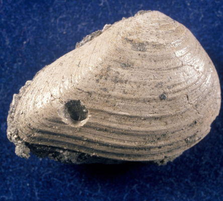
This fossil of a Late Cretaceous clam, Crassatellites roodensis, features a hole bored by a type of snail known as a naticid. Such holes were a cause of mortality for many clam species during this period.
Photograph by David R. Schwimmer
The New Georgia Encyclopedia does not hold the copyright for this media resource and can neither grant nor deny permission to republish or reproduce the image online or in print. All requests for permission to publish or reproduce the resource must be submitted to the rights holder.
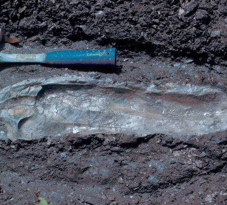
The Late Cretaceous oyster, Crassostrea cusseta, pictured alongside a hammer measuring 33 centimeters in length, could grow to 60 centimeters. This specimen was found at the Blufftown Formation in Stewart County.
Photograph by David R. Schwimmer
The New Georgia Encyclopedia does not hold the copyright for this media resource and can neither grant nor deny permission to republish or reproduce the image online or in print. All requests for permission to publish or reproduce the resource must be submitted to the rights holder.
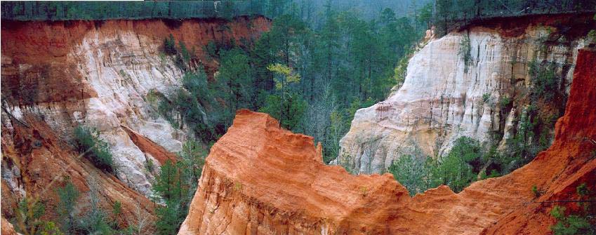
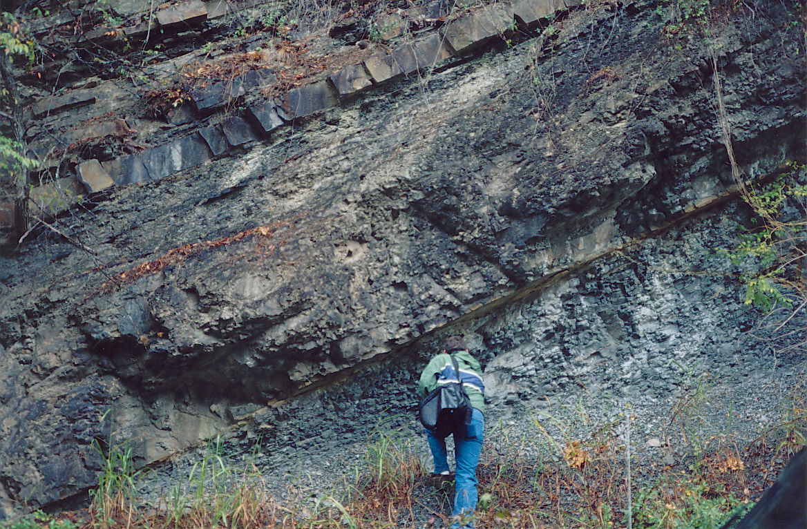
Providence Canyon, in Stewart County, reveals the white Providence Sand, which dates to the Late Cretaceous period, lying beneath the reddish Clayton Formation, which formed during the Paleogene period.
Photograph by Pamela J. W. Gore
The New Georgia Encyclopedia does not hold the copyright for this media resource and can neither grant nor deny permission to republish or reproduce the image online or in print. All requests for permission to publish or reproduce the resource must be submitted to the rights holder.
The Georgiacetus whale, an early ancestor of the modern whale, lived in the shallow sea that covered Georgia during the Eocene epoch (of the Paleogene period). The whale's hind legs and hips were functional.
Photograph by Pamela J. W. Gore
The New Georgia Encyclopedia does not hold the copyright for this media resource and can neither grant nor deny permission to republish or reproduce the image online or in print. All requests for permission to publish or reproduce the resource must be submitted to the rights holder.
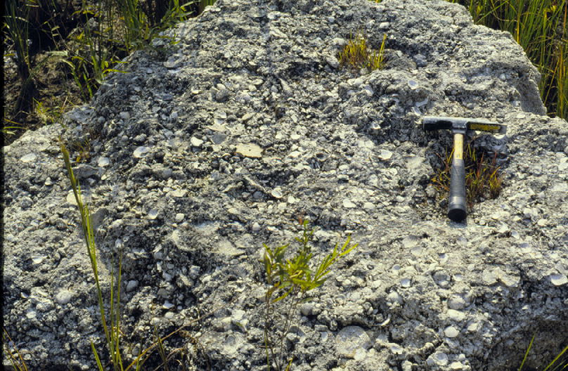
Pictured near Perry, in Houston County, the Tivola Limestone formed during the Late Eocene epoch, when sea levels in the region were particularly high. The Tivola is considered to be an extension of the Ocala Limestone, a white, fossiliferous limestone that formed during the Late Eocene in the Dougherty Plain of southwest Georgia.
Photograph by Pamela J. W. Gore
The New Georgia Encyclopedia does not hold the copyright for this media resource and can neither grant nor deny permission to republish or reproduce the image online or in print. All requests for permission to publish or reproduce the resource must be submitted to the rights holder.
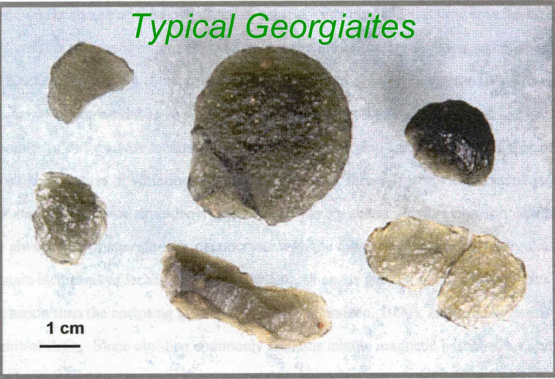
Georgiaites, or tektites, are natural glasses formed when an asteroid or meteorite collides with the earth. Many scientists believe that georgiaites formed as a result of the meteorite impact that created the Chesapeake Bay Crater in Virginia around 35 million years ago.
Photograph by Edward Albin
The New Georgia Encyclopedia does not hold the copyright for this media resource and can neither grant nor deny permission to republish or reproduce the image online or in print. All requests for permission to publish or reproduce the resource must be submitted to the rights holder.
Exposed layers of sandstone are visible in the walls of Cloudland Canyon, part of the Appalachain Plateau geologic province in the northwest corner of Georgia. The vegetated slopes below the sandstone contain gray shale with interbedded sandstone, siderite, and coal.
Photograph by Pamela J. W. Gore
The New Georgia Encyclopedia does not hold the copyright for this media resource and can neither grant nor deny permission to republish or reproduce the image online or in print. All requests for permission to publish or reproduce the resource must be submitted to the rights holder.
Lookout Mountain, located in Dade County, is part of the Appalachian Plateau geologic province. Georgia shares the mountain with Alabama and Tennessee.
Image from Andy Montgomery
The New Georgia Encyclopedia does not hold the copyright for this media resource and can neither grant nor deny permission to republish or reproduce the image online or in print. All requests for permission to publish or reproduce the resource must be submitted to the rights holder.
Rock Town, located on Pigeon Mountain in Walker County, is a natural rock formation composed of sandstone layers interbedded with shales. Pigeon Mountain is part of the Appalachian Plateau geologic province.
Courtesy of Georgia Department of Economic Development.
The New Georgia Encyclopedia does not hold the copyright for this media resource and can neither grant nor deny permission to republish or reproduce the image online or in print. Requests for permission to publish or reproduce the resource may need to be submitted to the Georgia Department of Economic Development.
Pine Mountain, located in Harris County, is part of the Piedmont geologic province. Located between the Blue Ridge Mountains and the Coastal Plain, the Piedmont forms the foothills of the Appalachian Mountains, which formed during the Paleozoic era.
Courtesy of Georgia Department of Economic Development.
The New Georgia Encyclopedia does not hold the copyright for this media resource and can neither grant nor deny permission to republish or reproduce the image online or in print. Requests for permission to publish or reproduce the resource may need to be submitted to the Georgia Department of Economic Development.
The New Georgia Encyclopedia does not hold the copyright for this media resource and can neither grant nor deny permission to republish or reproduce the image online or in print. All requests for permission to publish or reproduce the resource must be submitted to the rights holder.
The Chattahoochee River flows through Columbus, one of the cities located along the fall line marking the boundary between the Piedmont and Coastal Plain geologic provinces. The hard rocks of the Piedmont form outcrops that create rapids and waterfalls along the fall line.
Photograph by andrewI04Â
The New Georgia Encyclopedia does not hold the copyright for this media resource and can neither grant nor deny permission to republish or reproduce the image online or in print. All requests for permission to publish or reproduce the resource must be submitted to the rights holder.
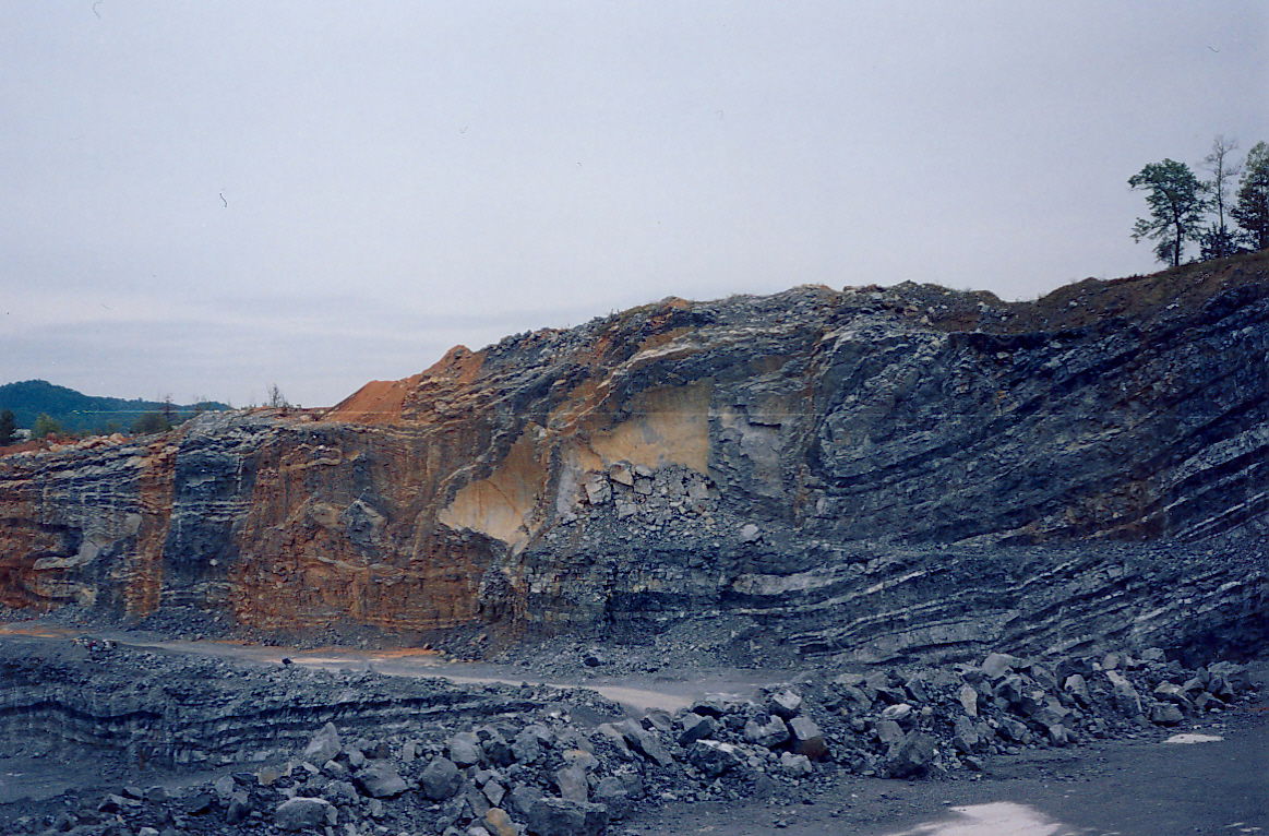
The Rising Fawn thrust fault, located in the Valley and Ridge geologic province of northwest Georgia, was formed during the Alleghanian orogeny, the third mountain-building event of the Paleozoic Era.
Photograph by Pamela J. W. Gore
The New Georgia Encyclopedia does not hold the copyright for this media resource and can neither grant nor deny permission to republish or reproduce the image online or in print. All requests for permission to publish or reproduce the resource must be submitted to the rights holder.
Rock strata of Taylor Ridge, part of the Valley and Ridge geographic province, are visible from Interstate 75, which runs through Ringgold Gap in northwest Georgia. The ridges of the province are formed of hard layers of sandstone or chert, while the valleys are composed of softer shale and limestone.
Courtesy of Tim Chowns
The New Georgia Encyclopedia does not hold the copyright for this media resource and can neither grant nor deny permission to republish or reproduce the image online or in print. All requests for permission to publish or reproduce the resource must be submitted to the rights holder.
Slate folds, which formed during the mountain-building events of the Paleozoic Era, are visible around Rockmart in the Valley and Ridge geologic province of northwest Georgia.
Photograph by Pamela J. W. Gore
The New Georgia Encyclopedia does not hold the copyright for this media resource and can neither grant nor deny permission to republish or reproduce the image online or in print. All requests for permission to publish or reproduce the resource must be submitted to the rights holder.
Lula Lake and Lula Falls in Walker County showcase Georgia's natural geologic beauty, which draws visitors to the state each year.
Image from Jeff Moore
The New Georgia Encyclopedia does not hold the copyright for this media resource and can neither grant nor deny permission to republish or reproduce the image online or in print. All requests for permission to publish or reproduce the resource must be submitted to the rights holder.
The unconsolidated sandstone bluffs of Providence Canyon in Stewart County were formed during the Cretaceous Period and are among the oldest exposed Coastal Plains rock formations in the state.
Courtesy of Matthew M. Moye
The New Georgia Encyclopedia does not hold the copyright for this media resource and can neither grant nor deny permission to republish or reproduce the image online or in print. All requests for permission to publish or reproduce the resource must be submitted to the rights holder.
Sand dunes form along the coast of Cumberland Island off the coast of Georgia. Dunes are the primary geological feature of the state's barrier islands and represent the youngest geological deposits in the state.
Image from anoldent
The New Georgia Encyclopedia does not hold the copyright for this media resource and can neither grant nor deny permission to republish or reproduce the image online or in print. All requests for permission to publish or reproduce the resource must be submitted to the rights holder.
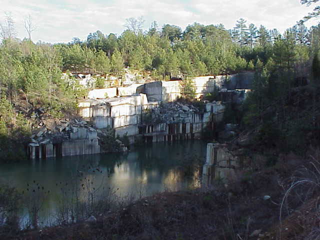
The Oglesby Quarry in Elberton, abandoned in 2003, is one of the many granite quarries to contribute to Georgia's economy. Formed approximately 1 billion years ago, granite is one of the oldest rock types found in Georgia.
Photograph by Clay Ouzts
The New Georgia Encyclopedia does not hold the copyright for this media resource and can neither grant nor deny permission to republish or reproduce the image online or in print. All requests for permission to publish or reproduce the resource must be submitted to the rights holder.
Tallulah Falls are today part of the Tallulah Gorge State Park in northeast Georgia.
Image from Rain0975
The New Georgia Encyclopedia does not hold the copyright for this media resource and can neither grant nor deny permission to republish or reproduce the image online or in print. All requests for permission to publish or reproduce the resource must be submitted to the rights holder.
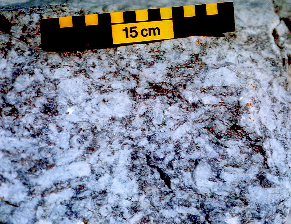
The Grenville gneisses were formed around 1 billion years ago during the Grenville Orogeny. The oldest rocks in Georgia, these gneisses form the "basement" upon which younger rocks were deposited during the formation of the Appalachian mountain chain.
Photograph by Pamela J. W. Gore
The New Georgia Encyclopedia does not hold the copyright for this media resource and can neither grant nor deny permission to republish or reproduce the image online or in print. All requests for permission to publish or reproduce the resource must be submitted to the rights holder.
The Chattanooga Shale, located in northwest Georgia, was formed approximately 350 million years ago, when the area was covered by a shallow sea.
Photograph by Pamela J. W. Gore
The New Georgia Encyclopedia does not hold the copyright for this media resource and can neither grant nor deny permission to republish or reproduce the image online or in print. All requests for permission to publish or reproduce the resource must be submitted to the rights holder.
Stone Mountain Park encompasses 3,200 acres just sixteen miles east of downtown Atlanta. Formed around 300 million years ago during the Paleozoic Era, the mountain itself is the world's largest mass of exposed granite.
Image from Darryl Pierce
The New Georgia Encyclopedia does not hold the copyright for this media resource and can neither grant nor deny permission to republish or reproduce the image online or in print. All requests for permission to publish or reproduce the resource must be submitted to the rights holder.
Coastal tides bring nutrients from estuaries connected by tidal creeks to the marshes. Outgoing tides carry nutritious marsh products back into the estuaries. There, the products help to sustain large numbers of other marine organisms. The outgoing tides also remove wastes from the marsh.
Courtesy of Georgia Department of Economic Development.
The New Georgia Encyclopedia does not hold the copyright for this media resource and can neither grant nor deny permission to republish or reproduce the image online or in print. Requests for permission to publish or reproduce the resource may need to be submitted to the Georgia Department of Economic Development.
The New Georgia Encyclopedia does not hold the copyright for this media resource and can neither grant nor deny permission to republish or reproduce the image online or in print. All requests for permission to publish or reproduce the resource must be submitted to the rights holder.
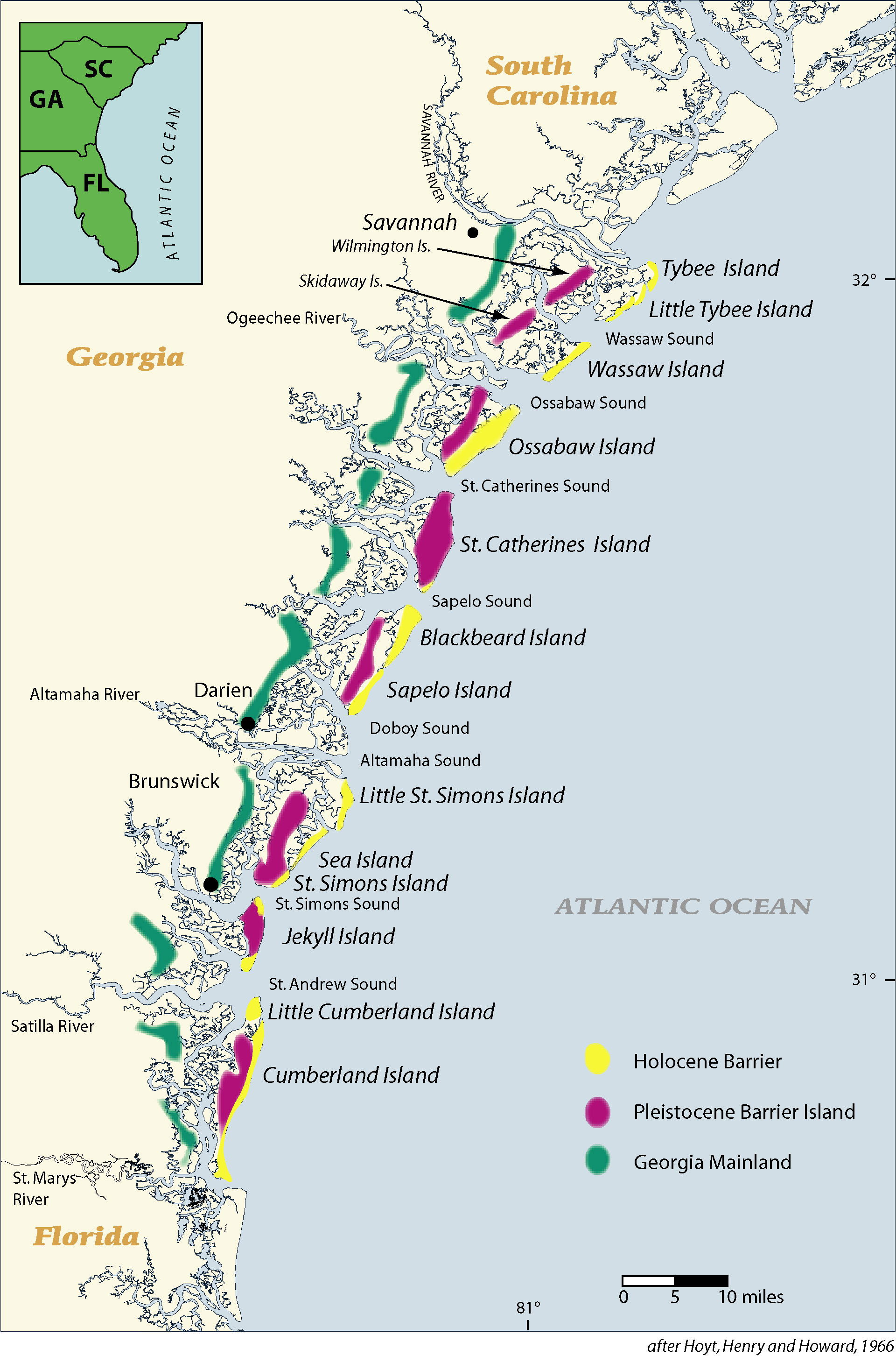
Barrier islands, also known as the Golden Isles, line the coast of Georgia. The Lower Coastal Plain extends for sixty-five to seventy miles between the Savannah and St. Marys rivers and contains the remains of older and higher shorelines west of the present coast. Previously occupied by Native Americans, today these ancient shorelines support the cities of Savannah, Darien, and Brunswick.
Courtesy of V. J. Henry
The New Georgia Encyclopedia does not hold the copyright for this media resource and can neither grant nor deny permission to republish or reproduce the image online or in print. All requests for permission to publish or reproduce the resource must be submitted to the rights holder.
The topography of Jekyll Island illustrates the process of erosion occurring on most of Georgia's barrier islands. Many of the islands consist of a Pleistocene-era core to which a Holocene-era barrier island became attached around 5,000 years ago. Subsequent erosion by the rising sea has removed most of the Holocene barrier sands.
Courtesy of V. J. Henry
The New Georgia Encyclopedia does not hold the copyright for this media resource and can neither grant nor deny permission to republish or reproduce the image online or in print. All requests for permission to publish or reproduce the resource must be submitted to the rights holder.
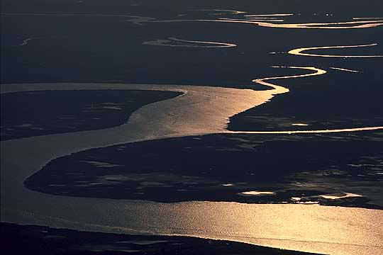
Within the ebb-tide delta system, sediments are brought into the marshlands by flooding tides and then redeposited seaward of the inlet by ebbing tides. Shoals formed as a result of this tidal action eventually drift south with the currents and weld onto the northern portion of barrier islands.
Courtesy of V. J. Henry
The New Georgia Encyclopedia does not hold the copyright for this media resource and can neither grant nor deny permission to republish or reproduce the image online or in print. All requests for permission to publish or reproduce the resource must be submitted to the rights holder.
Tidal marshlands are an important feature of Georgia's coastal ecosystem. The two- to five-mile-wide areas between Georgia's barrier islands and mainland are dominated by saltwater wetlands, while brackish and freshwater wetlands extend inland for an additional ten miles along the estuaries.
Photograph by Steven Miller
The New Georgia Encyclopedia does not hold the copyright for this media resource and can neither grant nor deny permission to republish or reproduce the image online or in print. All requests for permission to publish or reproduce the resource must be submitted to the rights holder.
Tybee Island, formerly known as Savannah Beach, is located about eighteen miles east of Savannah. A popular destination for tourists, Tybee is home to approximately 3,400 year-round residents.
Image from James St. John
The New Georgia Encyclopedia does not hold the copyright for this media resource and can neither grant nor deny permission to republish or reproduce the image online or in print. All requests for permission to publish or reproduce the resource must be submitted to the rights holder.
The contents of five river watersheds flow into Georgia's estuaries and marshlands. Pollutants from as far away as Atlanta and Augusta, along with those from points in between, can adversely affect the health and productivity of the coastal ecosystem.
Courtesy of V. J. Henry
The New Georgia Encyclopedia does not hold the copyright for this media resource and can neither grant nor deny permission to republish or reproduce the image online or in print. All requests for permission to publish or reproduce the resource must be submitted to the rights holder.
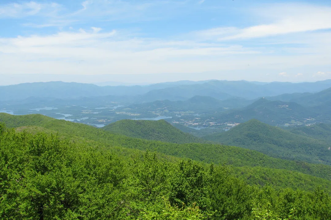
Brasstown Bald, located partly in Union County and partly in Towns County, was formed by the breaching of thrust faults by erosion, resulting in the exposure of rocks once deeply buried in the Appalachian Mountains. Situated in the Blue Ridge province, Brasstown Bald is the highest point in Georgia.
Photograph by Vicki's Nature
The New Georgia Encyclopedia does not hold the copyright for this media resource and can neither grant nor deny permission to republish or reproduce the image online or in print. All requests for permission to publish or reproduce the resource must be submitted to the rights holder.
Blood Mountain, at 4,461 feet, is the highest peak along the Appalachian Trail in Georgia and the sixth highest mountain in the state. The mountain is located near the line between Union and Lumpkin counties and may have been named for a battle between the Cherokees and the Creeks.
Photograph by Sammy Hancock
The New Georgia Encyclopedia does not hold the copyright for this media resource and can neither grant nor deny permission to republish or reproduce the image online or in print. All requests for permission to publish or reproduce the resource must be submitted to the rights holder.
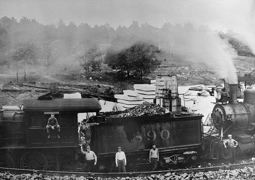
Workers for the Blue Ridge Marble Company stand in the quarry at Nelson in Pickens County around 1910. The rich marble deposits of the Murphy Marble Belt, located along the western edge of the Blue Ridge province, gave rise to a booming marble industry in that part of the state during the nineteenth century.
Courtesy of Georgia Archives, Vanishing Georgia, # pck077-82b.
The New Georgia Encyclopedia does not hold the copyright for this media resource and can neither grant nor deny permission to republish or reproduce the image online or in print. Requests for permission to publish or reproduce the resource should be submitted to the Georgia Archives.
Tallulah Gorge, located in the Blue Ridge province of Georgia, is formed by high, steep quartzite bluffs. The gorge has been a popular destination for visitors since the late nineteenth century and today is home to the Tallulah Gorge State Park.
Image from Andrew Piazza
The New Georgia Encyclopedia does not hold the copyright for this media resource and can neither grant nor deny permission to republish or reproduce the image online or in print. All requests for permission to publish or reproduce the resource must be submitted to the rights holder.
Mount Yonah, located in White County between Cleveland and Helen, is best known for its granite outcrops, formed by granite magma intruding the overlying stacks of metamorphic rocks about 375 million years ago. The outcrops are one of the favorite spots for rock climbers in the state.
Image from Andrew Partain
The New Georgia Encyclopedia does not hold the copyright for this media resource and can neither grant nor deny permission to republish or reproduce the image online or in print. All requests for permission to publish or reproduce the resource must be submitted to the rights holder.