The New Georgia Encyclopedia is supported by funding from A More Perfect Union, a special initiative of the National Endowment for the Humanities.
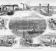
A. R. Waud's sketch Rice Culture on the Ogeechee, Near Savannah, Georgia depicts enslaved African Americans working in the rice fields.
From Harper's Weekly
The New Georgia Encyclopedia does not hold the copyright for this media resource and can neither grant nor deny permission to republish or reproduce the image online or in print. All requests for permission to publish or reproduce the resource must be submitted to the rights holder.
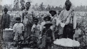
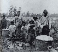
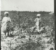
An enslaved family picking cotton outside Savannah in the 1850s.
Courtesy of New York Historical Society, Photograph by Pierre Havens..
The New Georgia Encyclopedia does not hold the copyright for this media resource and can neither grant nor deny permission to republish or reproduce the image online or in print. All requests for permission to publish or reproduce the resource must be submitted to the rights holder.
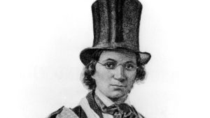
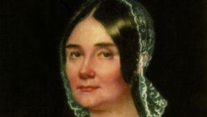
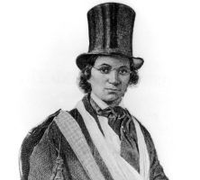
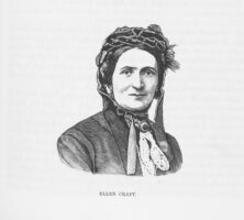
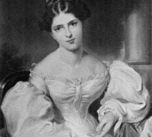
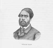
To escape slavery, light-skinned Ellen Craft disguised herself as a male enslaver. Her husband, William, who was darker skinned, posed as her valet. They successfully traveled to the North, and eventually to England, where they published a narrative recounting their lives in slavery and their daring escape.
The New Georgia Encyclopedia does not hold the copyright for this media resource and can neither grant nor deny permission to republish or reproduce the image online or in print. All requests for permission to publish or reproduce the resource must be submitted to the rights holder.
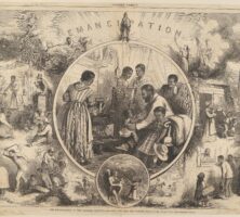
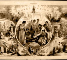
Detail from an 1863 Thomas Nast illustration depicting freedpeople after emancipation. Freedpeople set about defining the economic and social freedom they previously could only imagine.
Courtesy of The Metropolitan Museum of Art, Harris Brisbane Dick Fund, 1929.
The New Georgia Encyclopedia does not hold the copyright for this media resource and can neither grant nor deny permission to republish or reproduce the image online or in print. All requests for permission to publish or reproduce the resource must be submitted to the rights holder.
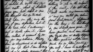
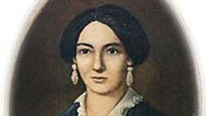
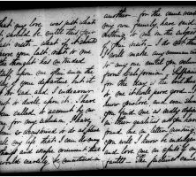
This letter, dated June 24, 1859, shows a correspondence between Elizabeth Craig and her soon-to-be husband, James Robb. The couple married in 1860 and relocated to Chicago before the outbreak of the Civil War.
The Historic New Orleans Collection (Williams Research Center), James Robb Collection , #MSS 265.
The New Georgia Encyclopedia does not hold the copyright for this media resource and can neither grant nor deny permission to republish or reproduce the image online or in print. All requests for permission to publish or reproduce the resource must be submitted to the rights holder.
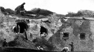
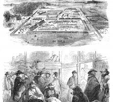
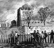
Camp Douglas, depicted in this etching from Harper's Weekly, served as a prisoner of war camp during the Civil War. Elizabeth Church Robb frequently visited the camp to assist Confederate prisoners—a fact that was later used to sensationalize her legacy as a Lost Cause heroine.
From Harper's Weekly, Wikimedia Commons
The New Georgia Encyclopedia does not hold the copyright for this media resource and can neither grant nor deny permission to republish or reproduce the image online or in print. All requests for permission to publish or reproduce the resource must be submitted to the rights holder.
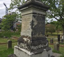
Elizabeth Church Robb died in 1868 and was buried in a family plot at the Oconee Hill Cemetery in Athens. Though Robb died from ovarian cancer, her obituary was embellished and reprinted to bolster Lost Cause mythology.
From the Willson Center Digital Humanities Lab, Death and Human History in Athens.
The New Georgia Encyclopedia does not hold the copyright for this media resource and can neither grant nor deny permission to republish or reproduce the image online or in print. All requests for permission to publish or reproduce the resource must be submitted to the rights holder.
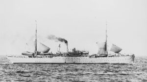
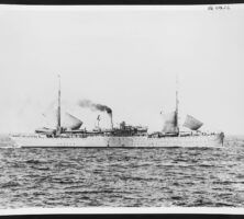
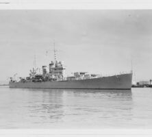
The fourth USS Savannah (CL-42) engaged in Atlantic and Meditteranean operations during World War II (1941-45), most notably Operation Torch, the allied invasion of North Africa.
Photograph by Naval History and Heritage Command
The New Georgia Encyclopedia does not hold the copyright for this media resource and can neither grant nor deny permission to republish or reproduce the image online or in print. All requests for permission to publish or reproduce the resource must be submitted to the rights holder.
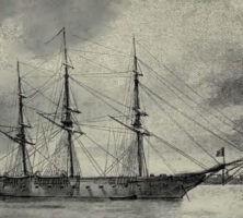
The second USS Savannah completed naval operations in the Mexican and Civil Wars.
From Old Naval Days: Sketches From the Life of Rear Admiral William Radford, U. S. N. by Sophie Radford De Meissner, Wikimedia
The New Georgia Encyclopedia does not hold the copyright for this media resource and can neither grant nor deny permission to republish or reproduce the image online or in print. All requests for permission to publish or reproduce the resource must be submitted to the rights holder.
The third USS Savannah (AS-8) served as a submarine tender during World War I (1917-18).
Photograph by Naval History and Heritage Command
The New Georgia Encyclopedia does not hold the copyright for this media resource and can neither grant nor deny permission to republish or reproduce the image online or in print. All requests for permission to publish or reproduce the resource must be submitted to the rights holder.
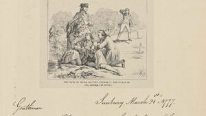
This 1777 engraving depicts the fatal duel between Button Gwinnett and Lachlan McIntosh.
Courtesy of New York Public Library, Manuscripts and Archives Division
The New Georgia Encyclopedia does not hold the copyright for this media resource and can neither grant nor deny permission to republish or reproduce the image online or in print. All requests for permission to publish or reproduce the resource must be submitted to the rights holder.
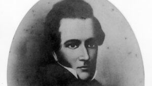
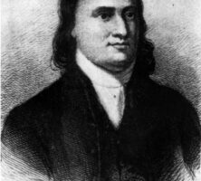
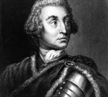
Button Gwinnett served in Georgia's colonial legislature, in the Second Continental Congress, and as president of Georgia's Revolutionary Council of Safety. He was one of three Georgia signers of the Declaration of Independence.
The New Georgia Encyclopedia does not hold the copyright for this media resource and can neither grant nor deny permission to republish or reproduce the image online or in print. Requests for permission to publish or reproduce the resource should be submitted to the Hargrett Manuscript and Rare Book Library at the University of Georgia.
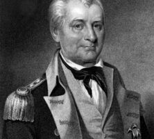
Lachlan McIntosh distinguished himself in a career that evolved over three critical eras in the state's early history, from the colonial period to the Revolutionary War to statehood.
The New Georgia Encyclopedia does not hold the copyright for this media resource and can neither grant nor deny permission to republish or reproduce the image online or in print. All requests for permission to publish or reproduce the resource must be submitted to the rights holder.
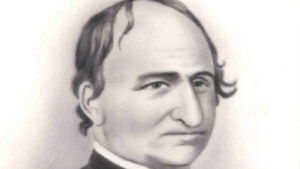
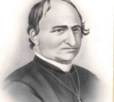
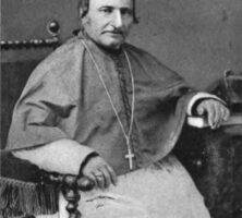
Augustin Verot, known as the "Rebel Bishop" for his support of the Confederacy during the Civil War, became bishop of the Diocese of Savannah in 1861 and led the Catholic community through the turbulent years of war and Reconstruction.
Courtesy of Catholic Diocese of Savannah Archives
The New Georgia Encyclopedia does not hold the copyright for this media resource and can neither grant nor deny permission to republish or reproduce the image online or in print. All requests for permission to publish or reproduce the resource must be submitted to the rights holder.
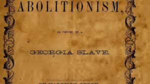
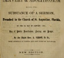
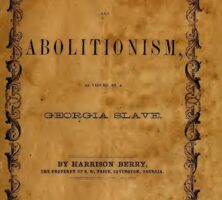
On January 4, 1861 Augustin Verot delivered a sermon defending the practice of slavery and condemning abolitionism. It was later reprinted as a Confederate tract and circulated throughout the region, earning Verot wide acclaim in southern states.
The New Georgia Encyclopedia does not hold the copyright for this media resource and can neither grant nor deny permission to republish or reproduce the image online or in print. All requests for permission to publish or reproduce the resource must be submitted to the rights holder.
In the aftermath of the Civil War, Augustin Verot called for Catholic bishops to support the construction of schools and churches for freedmen.
The New Georgia Encyclopedia does not hold the copyright for this media resource and can neither grant nor deny permission to republish or reproduce the image online or in print. All requests for permission to publish or reproduce the resource must be submitted to the rights holder.
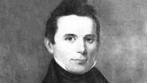
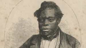
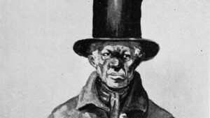
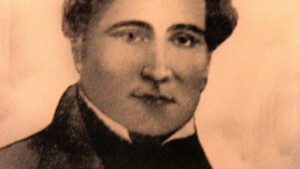
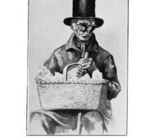
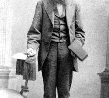
This portrait was published with the Life of William Grimes, the Runaway Slave. The book, the first slave narrative printed in the U.S., was first published in New York City in 1825.
Photograph from Dwight C. Kilbourne, The Bench and Bar of Litchfield County, Connecticut, 1709-1909: Biographical Sketches of Members, History and Catalogue of the Litchfield Law School Historical Notes
The New Georgia Encyclopedia does not hold the copyright for this media resource and can neither grant nor deny permission to republish or reproduce the image online or in print. All requests for permission to publish or reproduce the resource must be submitted to the rights holder.
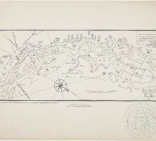
This map of Savannah River-area rice plantations was created in 1825, the same year William Grimes first published his narrative in New York City. Grimes served six enslavers in Savannah between 1811 and 1815 before escaping to freedom in New England.
Chatham County Map Portfolio, compiled by workers of the Writers program of the Works Projects Administration in the State of Georgia. Sponsored by the Georgia Society of the Colonial Dames of America.
The New Georgia Encyclopedia does not hold the copyright for this media resource and can neither grant nor deny permission to republish or reproduce the image online or in print. All requests for permission to publish or reproduce the resource must be submitted to the rights holder.
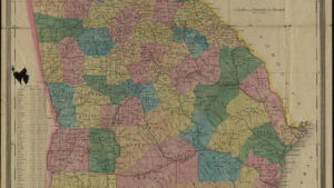
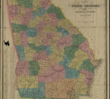
William G. Bonner's Pocket Map of the State of Georgia was published in Milledgeville in 1851. Bonner was a civil engineer who published a series of pocket maps in the mid-nineteenth century.
The New Georgia Encyclopedia does not hold the copyright for this media resource and can neither grant nor deny permission to republish or reproduce the image online or in print. Requests for permission to publish or reproduce the resource should be submitted to the Hargrett Manuscript and Rare Book Library at the University of Georgia.
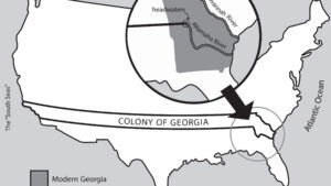
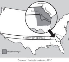
King George II granted James Oglethorpe and the Trustees a charter in 1732 to establish the colony of Georgia. This charter provided, among other things, that the new colony would consist of all the land between the headwaters of the Savannah and the Altamaha rivers, with its eastern boundary formed by the Atlantic Ocean and its western boundary by the "south seas," a reference to the Pacific Ocean.
Map by John Nelson. Reprinted by permission of William J. Morton
The New Georgia Encyclopedia does not hold the copyright for this media resource and can neither grant nor deny permission to republish or reproduce the image online or in print. All requests for permission to publish or reproduce the resource must be submitted to the rights holder.
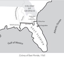
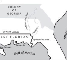
In 1763 the British divided what had been Spanish Florida into the two new colonies of West Florida and East Florida, with the Apalachicola River serving as the dividing line between them. East Florida was all the land east of the Apalachicola River, with St. Augustine as its capital.
Map by John Nelson. Reprinted by permission of William J. Morton
The New Georgia Encyclopedia does not hold the copyright for this media resource and can neither grant nor deny permission to republish or reproduce the image online or in print. All requests for permission to publish or reproduce the resource must be submitted to the rights holder.
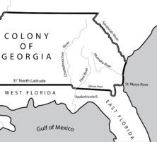
In 1763 the British divided what had been Spanish Florida into the two new colonies of West Florida and East Florida, with the Apalachicola River serving as the dividing line between them. West Florida, with Pensacola as its capital, extended west to the Mississippi River.
Map by John Nelson. Reprinted by permission of William J. Morton
The New Georgia Encyclopedia does not hold the copyright for this media resource and can neither grant nor deny permission to republish or reproduce the image online or in print. All requests for permission to publish or reproduce the resource must be submitted to the rights holder.
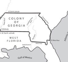
The appointment of James Wright in 1760 as governor of Georgia coincided with a period of expansion. By 1764 the boundaries of the colony had expanded to include those territories between the Mississippi and Chattahoochee rivers that had not been granted to the Florida colonies.
Map by John Nelson. Reprinted by permission of William J. Morton
The New Georgia Encyclopedia does not hold the copyright for this media resource and can neither grant nor deny permission to republish or reproduce the image online or in print. All requests for permission to publish or reproduce the resource must be submitted to the rights holder.
In 1767 the governor of West Florida received permission from the king of England to advance the colony's northern border along the Mississippi and Chattahoochee rivers, where royal trading posts were located. Georgia's land holdings significantly decreased as a result.
Map by John Nelson. Reprinted by permission of William J. Morton
The New Georgia Encyclopedia does not hold the copyright for this media resource and can neither grant nor deny permission to republish or reproduce the image online or in print. All requests for permission to publish or reproduce the resource must be submitted to the rights holder.
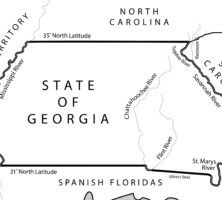
The 1783 Treaty of Paris, which ended the Revolutionary War (1775-83), fixed the 31st latitude north as the southern boundary of the new United States. The line extended from the Mississippi River eastward to the Chattahoochee River, moved down that river to its junction with the Flint River, and then followed a direct line east to the headwaters of the St. Marys River.
Map by John Nelson. Reprinted by permission of William J. Morton
The New Georgia Encyclopedia does not hold the copyright for this media resource and can neither grant nor deny permission to republish or reproduce the image online or in print. All requests for permission to publish or reproduce the resource must be submitted to the rights holder.
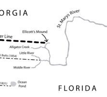
The Orr-Whitner line was accepted by Florida in 1861 and Georgia in 1866 as their official boundary, although the outbreak of the Civil War (1861-65) delayed the line's approval by the U.S. Congress until 1872.
Map by John Nelson. Reprinted by permission of William J. Morton
The New Georgia Encyclopedia does not hold the copyright for this media resource and can neither grant nor deny permission to republish or reproduce the image online or in print. All requests for permission to publish or reproduce the resource must be submitted to the rights holder.
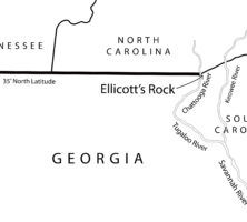
In 1811 Georgia hired Andrew Ellicott to survey and mark the location of the 35th latitude north, which formed the boundary between Georgia and North Carolina. In an 1812 letter to North Carolina governor William Hawkins, Ellicott states: "In the parallel of 35 degree N. latitude, on the west side of the Chatoga river, a stone is set up marked on the South side (G. lat 35 N.) and on the north side, (N.C.) for North Carolina." This map locates what is currently and erroneously called Ellicott's Rock on the east side of the Chattooga River.
Map by John Nelson. Reprinted by permission of William J. Morton
The New Georgia Encyclopedia does not hold the copyright for this media resource and can neither grant nor deny permission to republish or reproduce the image online or in print. All requests for permission to publish or reproduce the resource must be submitted to the rights holder.
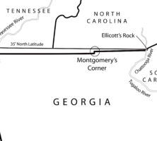
This map shows the surveyed line as marked by James Camak, which set Georgia's northern boundary line south of the 35th latitude north, including the offset known as Montgomery's Corner.
Map by John Nelson. Reprinted by permission of William J. Morton
The New Georgia Encyclopedia does not hold the copyright for this media resource and can neither grant nor deny permission to republish or reproduce the image online or in print. All requests for permission to publish or reproduce the resource must be submitted to the rights holder.
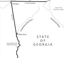
Following the 1802 Article of Agreement and Cession, Georgia's new western boundary began with the juncture of the Chattahoochee and Flint rivers in southwest Georgia and proceeded north to the great bend of the river (at present-day West Point, Georgia). From there it stretched for 160 miles to the Indian village of Nickajack on the Tennessee River and continued from there up to the 35th latitude north.
Map by John Nelson. Reprinted by permission of William J. Morton
The New Georgia Encyclopedia does not hold the copyright for this media resource and can neither grant nor deny permission to republish or reproduce the image online or in print. All requests for permission to publish or reproduce the resource must be submitted to the rights holder.
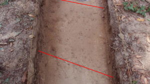
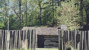
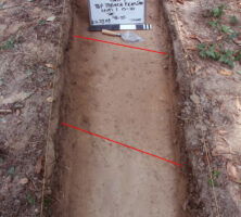
The east wall trench of Fort Daniel, constructed in Gwinnett County in 1814, was discovered by researchers with the Gwinnett Archaeological Research Society in 2009. Other intact buried features at the site include the entire stockade wall trench and evidence of two corner blockhouses.
Courtesy of The Fort Daniel Foundation, Inc.
The New Georgia Encyclopedia does not hold the copyright for this media resource and can neither grant nor deny permission to republish or reproduce the image online or in print. All requests for permission to publish or reproduce the resource must be submitted to the rights holder.
The New Georgia Encyclopedia does not hold the copyright for this media resource and can neither grant nor deny permission to republish or reproduce the image online or in print. All requests for permission to publish or reproduce the resource must be submitted to the rights holder.
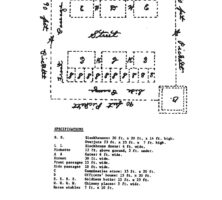
U.S. secretary of war Henry Knox sent this sketch of a proposed frontier fort to Georgia governor George Mathews in 1794. The drawing closely resembles the archaeological remains at the site of Fort Daniel, a stockade constructed in 1814 at Hog Mountain, in Gwinnett County.
Courtesy of James D'Angelo
The New Georgia Encyclopedia does not hold the copyright for this media resource and can neither grant nor deny permission to republish or reproduce the image online or in print. All requests for permission to publish or reproduce the resource must be submitted to the rights holder.
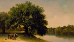
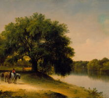
British artist Thomas Addison Richards painted River Plantation (1855-60) from sketches made in Georgia during his travels through the South in the 1840s. Oil on canvas (20 1/4" x 30").
Courtesy of Morris Museum of Art
The New Georgia Encyclopedia does not hold the copyright for this media resource and can neither grant nor deny permission to republish or reproduce the image online or in print. All requests for permission to publish or reproduce the resource must be submitted to the rights holder.
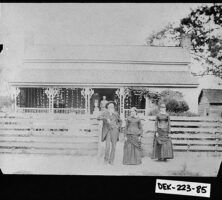
DeKalb County resident John Brandon Morris (far left) is pictured at his home, Cedar Grove, around the time of the Civil War.
Courtesy of Georgia Archives, Vanishing Georgia, #
dek223-85.
The New Georgia Encyclopedia does not hold the copyright for this media resource and can neither grant nor deny permission to republish or reproduce the image online or in print. Requests for permission to publish or reproduce the resource should be submitted to the Georgia Archives.
Eligea and Hanna Ricketts of Porter Springs, in Lumpkin County, are pictured circa 1860. In that year nearly a third of Georgia's populace lived in the state's upcountry and mountain counties.
Courtesy of Georgia Archives, Vanishing Georgia, #
lum164.
The New Georgia Encyclopedia does not hold the copyright for this media resource and can neither grant nor deny permission to republish or reproduce the image online or in print. Requests for permission to publish or reproduce the resource should be submitted to the Georgia Archives.
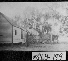
The Hofwyl Plantation (later the Hofwyl-Broadfield Plantation) in Glynn County, a state historic site, is pictured circa 1910. The plantation, established in 1801, produced rice until shortly after the Civil War ended in 1865.
Courtesy of Georgia Archives, Vanishing Georgia, #
gly189.
The New Georgia Encyclopedia does not hold the copyright for this media resource and can neither grant nor deny permission to republish or reproduce the image online or in print. Requests for permission to publish or reproduce the resource should be submitted to the Georgia Archives.
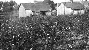
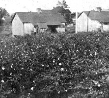
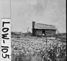
The homes of tenant farmers stand alongside a cotton field in Georgia. Landless whites, many of whom were farm tenants, made up nearly half the white populace in the state by 1860.
From Plantation Slavery in Georgia, by R. B. Flanders
The New Georgia Encyclopedia does not hold the copyright for this media resource and can neither grant nor deny permission to republish or reproduce the image online or in print. All requests for permission to publish or reproduce the resource must be submitted to the rights holder.
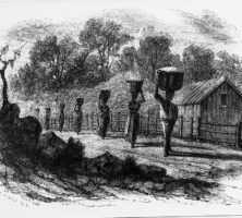
Enslaved workers are pictured carrying cotton to the gin at twilight in an 1854 drawing. Beginning in late July and continuing through December, enslaved workers would each pick between 250 and 300 pounds of cotton per day. The cotton gin, invented by Eli Whitney on a Georgia plantation in 1793, led to dramatically increased cotton yields and a greater dependence on slavery.
From Harper's New Monthly, March 1854
The New Georgia Encyclopedia does not hold the copyright for this media resource and can neither grant nor deny permission to republish or reproduce the image online or in print. All requests for permission to publish or reproduce the resource must be submitted to the rights holder.
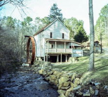
Healan's Mill in Hall County was a gristmill built prior to the Civil War. Most industry in antebellum Georgia was related to agriculture, which formed the base of the state's economy at that time.
Image from Neal Wellons
The New Georgia Encyclopedia does not hold the copyright for this media resource and can neither grant nor deny permission to republish or reproduce the image online or in print. All requests for permission to publish or reproduce the resource must be submitted to the rights holder.
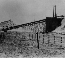
Timber from St. Simons Lumber Mills on St. Simons Island was shipped to market from this dock in Brunswick. After coming to a halt during the Civil War, the timber industry on the island was revived during the 1870s.
Courtesy of Coastal Georgia Historical Society.
The New Georgia Encyclopedia does not hold the copyright for this media resource and can neither grant nor deny permission to republish or reproduce the image online or in print. Requests for permission to publish or reproduce the resource may need to be submitted to the Coastal Georgia Historical Society.
The New Georgia Encyclopedia does not hold the copyright for this media resource and can neither grant nor deny permission to republish or reproduce the image online or in print. All requests for permission to publish or reproduce the resource must be submitted to the rights holder.
W. T. Wofford, pictured on a postcard distributed in 1881 during the International Cotton Exposition in Atlanta, was a military leader and state legislator. A native of Habersham County, Wofford served in both the Mexican War and Civil War.
The New Georgia Encyclopedia does not hold the copyright for this media resource and can neither grant nor deny permission to republish or reproduce the image online or in print. Requests for permission to publish or reproduce the resource should be submitted to the Hargrett Manuscript and Rare Book Library at the University of Georgia.
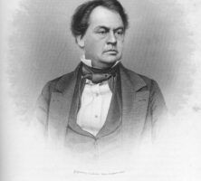
Georgia native Howell Cobb served as congressman (1843-51; 1855-57), Speaker of the U.S. House of Representatives (1849-51), governor of Georgia (1851-53), and secretary of the treasury (1857-60).
Courtesy of Hargrett Rare Book and Manuscript Library, University of Georgia Libraries, Georgia Photo File.
The New Georgia Encyclopedia does not hold the copyright for this media resource and can neither grant nor deny permission to republish or reproduce the image online or in print. Requests for permission to publish or reproduce the resource should be submitted to the Hargrett Manuscript and Rare Book Library at the University of Georgia.
Alexander Stephens, a native of Taliaferro County, was a prominent member of the Whig Party during the sectional crisis that arose in the wake of the Mexican War (1846-48). He later joined the ranks of the Democratic party and served as vice president of the Confederacy during the Civil War (1861-65).
The New Georgia Encyclopedia does not hold the copyright for this media resource and can neither grant nor deny permission to republish or reproduce the image online or in print. All requests for permission to publish or reproduce the resource must be submitted to the rights holder.
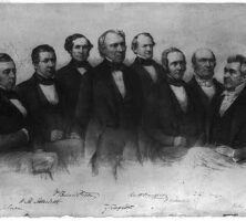
In 1849 George W. Crawford, a former governor of Georgia, joined U.S. president Zachary Taylor's cabinet as secretary of war. From left, Reverdy Johnson, William M. Meredith, William B. Preston, Zachary Taylor, Crawford, Jacob Collamer, Thomas Ewing, and John M. Clayton.
Courtesy of Library of Congress, Prints and Photographs Division
The New Georgia Encyclopedia does not hold the copyright for this media resource and can neither grant nor deny permission to republish or reproduce the image online or in print. All requests for permission to publish or reproduce the resource must be submitted to the rights holder.
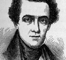
George W. Towns served as the governor of Georgia from 1847 to 1851. Earlier in his career, Towns served as both a state legislator and a U.S. congressman. Although he entered politics as a Unionist, Towns was known as an ardent states' rights secessionist during his governorship.
The New Georgia Encyclopedia does not hold the copyright for this media resource and can neither grant nor deny permission to republish or reproduce the image online or in print. All requests for permission to publish or reproduce the resource must be submitted to the rights holder.
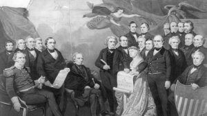
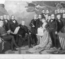
Painter Tompkins H. Matteson's Union, engraved by Henry S. Sadd, is a symbolic portrait celebrating the legislators responsible for brokering the Compromise of 1850. Henry Clay, John Calhoun, and Daniel Webster appear in the center, from left to right. Georgian Howell Cobb is portrayed in the far left background.
Courtesy of Library of Congress, Prints and Photographs Division
The New Georgia Encyclopedia does not hold the copyright for this media resource and can neither grant nor deny permission to republish or reproduce the image online or in print. All requests for permission to publish or reproduce the resource must be submitted to the rights holder.
Robert Toombs helped to lead Georgia out of the Union on the eve of the Civil War, though his support for the Georgia Platform in 1850 had demonstrated his commitment to preserving the Union.
The New Georgia Encyclopedia does not hold the copyright for this media resource and can neither grant nor deny permission to republish or reproduce the image online or in print. Requests for permission to publish or reproduce the resource should be submitted to the Hargrett Manuscript and Rare Book Library at the University of Georgia.
The Georgia Platform established Georgia's conditional acceptance of the Compromise of 1850. Much of the document followed a draft written by Charles Jones Jenkins, who later served as Georgia's governor from 1865 to 1868.
The New Georgia Encyclopedia does not hold the copyright for this media resource and can neither grant nor deny permission to republish or reproduce the image online or in print. Requests for permission to publish or reproduce the resource should be submitted to the Hargrett Manuscript and Rare Book Library at the University of Georgia.
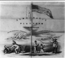
An 1856 political cartoon attacks the proslavery platform of the Democratic Party. In the lower right corner, an enslaved man and woman kneel before an overseer. One asks, "Is this democracy?" The overseer responds, "We will subdue you." In the left background a Kansas settlement burns, representing the violent response to the passage of the Kansas-Nebraska Act of 1854. This act, endorsed by Democrats, allowed for popular sovereignty to decide the slavery question in the western territories.
Courtesy of Library of Congress, Prints and Photographs Division
The New Georgia Encyclopedia does not hold the copyright for this media resource and can neither grant nor deny permission to republish or reproduce the image online or in print. All requests for permission to publish or reproduce the resource must be submitted to the rights holder.
In 1857 Joseph E. Brown edged aside better-known politicians to become the Democrats' gubernatorial candidate. He won decisively, and from then on he was unbeatable in statewide elections.
The New Georgia Encyclopedia does not hold the copyright for this media resource and can neither grant nor deny permission to republish or reproduce the image online or in print. Requests for permission to publish or reproduce the resource should be submitted to the Hargrett Manuscript and Rare Book Library at the University of Georgia.
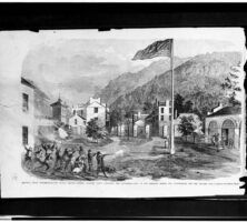
This 1859 sketch of the abolitionist John Brown's raid on Harpers Ferry, Virginia, appeared in Frank Leslie's Illustrated Newspaper and depicts an attack on the raiders at the railroad bridge. News of the raid intensified the call for secession by many southern slaveowners.
Courtesy of Library of Congress, Prints and Photographs Division
The New Georgia Encyclopedia does not hold the copyright for this media resource and can neither grant nor deny permission to republish or reproduce the image online or in print. All requests for permission to publish or reproduce the resource must be submitted to the rights holder.
Herschel Johnson, a nineteenth-century Georgia politician, is pictured in an 1860 Currier and Ives portrait. That same year, Johnson was the vice-presidential running mate for Democratic candidate Stephen Douglas, who lost the election to Abraham Lincoln.
Courtesy of Library of Congress, Prints and Photographs Division
The New Georgia Encyclopedia does not hold the copyright for this media resource and can neither grant nor deny permission to republish or reproduce the image online or in print. All requests for permission to publish or reproduce the resource must be submitted to the rights holder.
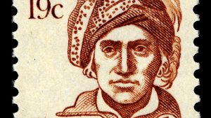
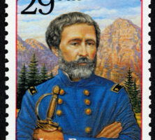
This 1990s postage stamp features Savannah native John C. Fremont, the first Republican US presidential candidate.
Courtesy of Smithsonian National Postal Museum
The New Georgia Encyclopedia does not hold the copyright for this media resource and can neither grant nor deny permission to republish or reproduce the image online or in print. All requests for permission to publish or reproduce the resource must be submitted to the rights holder.
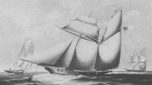
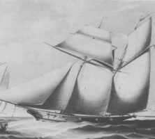
The Wanderer is pictured during the Civil War (1861-65). Prior to its service in the Union navy, the Wanderer was the last ship to transport African captives to Georgia as part of the slave trade. Commissioned as a yacht in 1857, the ship was converted into a slave ship the following year, and was seized by the Union navy in 1861.
Courtesy of U.S. Naval Historical Center
The New Georgia Encyclopedia does not hold the copyright for this media resource and can neither grant nor deny permission to republish or reproduce the image online or in print. All requests for permission to publish or reproduce the resource must be submitted to the rights holder.
Ella Gertrude Clanton Thomas kept an extensive journal chronicling her life as the daughter and wife of Augusta planters from 1848 to 1889. An edited version of the journal was published in 1990 under the title The Secret Eye.
Courtesy of Georgia Info, Digital Library of Georgia.
The New Georgia Encyclopedia does not hold the copyright for this media resource and can neither grant nor deny permission to republish or reproduce the image online or in print. Requests for permission to publish or reproduce the resource may need to be submitted to the Digital Library of Georgia.
During the 1820s Mirabeau Lamar, a Georgia native, established the Columbus Enquirer newspaper and served in the state senate. In 1835 he left Georgia for Texas, where he became president of the republic in 1838.
Reprinted by permission of Institute of Texan Cultures, # 068-0069, source unknown
The New Georgia Encyclopedia does not hold the copyright for this media resource and can neither grant nor deny permission to republish or reproduce the image online or in print. All requests for permission to publish or reproduce the resource must be submitted to the rights holder.
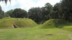
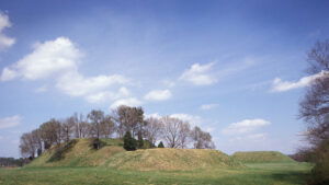
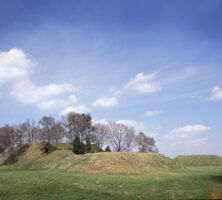
The Etowah Mounds in Bartow County include one of the largest Indian mounds in North America. The mounds, constructed during the Mississippian Period, served as platforms for public buildings in a town that occupied the site from around 1100 until the 1600s.
The New Georgia Encyclopedia does not hold the copyright for this media resource and can neither grant nor deny permission to republish or reproduce the image online or in print. Requests for permission to publish or reproduce the resource may need to be submitted to the Georgia Department of Community Affairs, Historic Preservation Division.
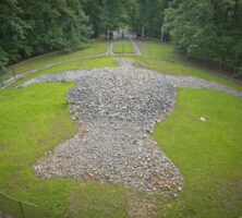
Rock Eagle, a stone effigy built by Native Americans during the Woodland Period, circa A.D. 200, is located in Putnam County. The structure, made of quartz cobbles, measures 102 feet across the wings.
Courtesy of Explore Georgia, Photograph by Ralph Daniel.
The New Georgia Encyclopedia does not hold the copyright for this media resource and can neither grant nor deny permission to republish or reproduce the image online or in print. Requests for permission to publish or reproduce the resource may need to be submitted to Explore Georgia.
The New Georgia Encyclopedia does not hold the copyright for this media resource and can neither grant nor deny permission to republish or reproduce the image online or in print. All requests for permission to publish or reproduce the resource must be submitted to the rights holder.
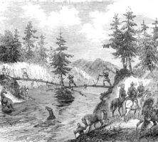
A drawing from Lambert A. Wilmer's Life, Travels and Adventures of Ferdinand de Soto, Discoverer of the Mississippi (1859) depicts Hernando de Soto and his men crossing the Chattahoochee River. The accidental introduction of European diseases by explorers destroyed many of the civilizations along the river's banks.
Courtesy of Florida State Archives, Photographic Collection.
The New Georgia Encyclopedia does not hold the copyright for this media resource and can neither grant nor deny permission to republish or reproduce the image online or in print. All requests for permission to publish or reproduce the resource must be submitted to the rights holder.
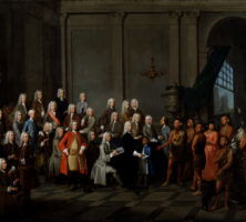
This oil painting by William Verelst shows the founders of Georgia, the Georgia Trustees, and a delegation of Georgia Indians in July 1734. One year later the Trustees persuaded the British government to support a ban on slavery in Georgia.
Courtesy of Georgia Info, Digital Library of Georgia.
The New Georgia Encyclopedia does not hold the copyright for this media resource and can neither grant nor deny permission to republish or reproduce the image online or in print. Requests for permission to publish or reproduce the resource may need to be submitted to the Digital Library of Georgia.
The New Georgia Encyclopedia does not hold the copyright for this media resource and can neither grant nor deny permission to republish or reproduce the image online or in print. All requests for permission to publish or reproduce the resource must be submitted to the rights holder.
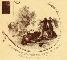
This sketch, likely a small portion of a larger work, depicts the Battle of Kettle Creek, which took place in Wilkes County on February 14, 1779, during the Revolutionary War. The original caption reads: "Engagement between the Whigs and Tories."
Courtesy of Kettle Creek Chapter of the National Society Daughters of the American Revolution
The New Georgia Encyclopedia does not hold the copyright for this media resource and can neither grant nor deny permission to republish or reproduce the image online or in print. All requests for permission to publish or reproduce the resource must be submitted to the rights holder.
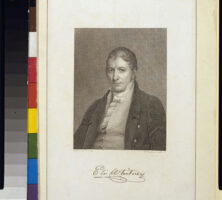
The inventor of the cotton gin, Eli Whitney lived in Georgia for just a year, on Catharine Greene's Mulberry Grove plantation near Savannah. After learning of the difficulty planters had with separating seeds from fibers in upland, or "short-staple," cotton, he set out to create a machine that could perform such a task more efficiently. His invention, the cotton gin, revolutionized the southern economy.
Courtesy of Library of Congress, Prints and Photographs Division
The New Georgia Encyclopedia does not hold the copyright for this media resource and can neither grant nor deny permission to republish or reproduce the image online or in print. All requests for permission to publish or reproduce the resource must be submitted to the rights holder.
The New Georgia Encyclopedia does not hold the copyright for this media resource and can neither grant nor deny permission to republish or reproduce the image online or in print. All requests for permission to publish or reproduce the resource must be submitted to the rights holder.
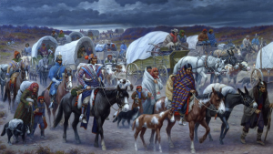
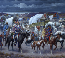
In his 1942 painting Cherokee Trail of Tears, Robert Lindneux depicts the forced journey of the Cherokees in 1838 to present-day Oklahoma.
Courtesy of Woolaroc Museum, Bartlesville, Oklahoma
The New Georgia Encyclopedia does not hold the copyright for this media resource and can neither grant nor deny permission to republish or reproduce the image online or in print. All requests for permission to publish or reproduce the resource must be submitted to the rights holder.
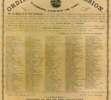
On January 21, 1861, the ordinance of secession was publicly signed in a ceremony by Georgia politicians. Two days earlier, delegates to a convention in Milledgeville voted 208 to 89 for the state to secede from the Union.
The New Georgia Encyclopedia does not hold the copyright for this media resource and can neither grant nor deny permission to republish or reproduce the image online or in print. Requests for permission to publish or reproduce the resource should be submitted to the Hargrett Manuscript and Rare Book Library at the University of Georgia.
Wilkes County native Robert Toombs, pictured circa 1865, served briefly as the Confederate government's secretary of state and as a brigadier general during the Civil War.
Courtesy of Library of Congress, Prints and Photographs Division
The New Georgia Encyclopedia does not hold the copyright for this media resource and can neither grant nor deny permission to republish or reproduce the image online or in print. All requests for permission to publish or reproduce the resource must be submitted to the rights holder.
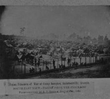
Union prisoners of war are pictured at the Andersonville Prison in Macon County on August 17, 1864. Malnutrition and poor sanitary conditions at the camp led to the deaths of nearly 13,000 of Andersonville's 45,000 prisoners, the highest mortality rate of any Civil War prison.
Courtesy of Civil War Treasures, New-York Historical Society
The New Georgia Encyclopedia does not hold the copyright for this media resource and can neither grant nor deny permission to republish or reproduce the image online or in print. All requests for permission to publish or reproduce the resource must be submitted to the rights holder.
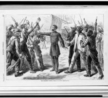
An 1868 sketch by A. R. Waud illustrates the difficulties faced by the Freedmen's Bureau, caught between white planters on one side (left) and formerly enslaved African Americans on the other (right). The bureau was established in 1865 after Union general William T. Sherman issued his Field Order No. 15, which called for the resettlement of freedpeople on confiscated lands.
Courtesy of Library of Congress, Prints and Photographs Division
The New Georgia Encyclopedia does not hold the copyright for this media resource and can neither grant nor deny permission to republish or reproduce the image online or in print. All requests for permission to publish or reproduce the resource must be submitted to the rights holder.
With his New South platform, Henry W. Grady advocated unity and trust between the North and South and helped to spur northern investment in Atlanta industries.
Courtesy of Stuart A. Rose Manuscript, Archives, and Rare Book Library, Emory University, Henry Woodfin Grady Papers.
The New Georgia Encyclopedia does not hold the copyright for this media resource and can neither grant nor deny permission to republish or reproduce the image online or in print. For more information about this resource, contact the Stuart A. Rose Manuscript, Archives, and Rare Book Library at Emory University.
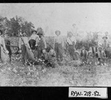
Sharecroppers, pictured in 1910, harvest cotton in Randolph County. Theoretically beneficial to both laborers and landowners, the sharecropping system typically left workers in deep debt to their landlords and creditors from one harvest season to the next.
Courtesy of Georgia Archives, Vanishing Georgia, #ran218-82.
The New Georgia Encyclopedia does not hold the copyright for this media resource and can neither grant nor deny permission to republish or reproduce the image online or in print. Requests for permission to publish or reproduce the resource should be submitted to the Georgia Archives.
In 1892 Georgia politics was shaken by the arrival of the Populist Party. Led by Thomas E. Watson of McDuffie County, this new party mainly appealed to white farmers, many of whom had been impoverished by debt and low cotton prices in the 1880s and 1890s. The Populists also attempted to win the support of Black farmers away from the Republican Party.
Courtesy of Georgia Historical Society.
The New Georgia Encyclopedia does not hold the copyright for this media resource and can neither grant nor deny permission to republish or reproduce the image online or in print. All requests for permission to publish or reproduce the resource must be submitted to Georgia Historical Society.
The New Georgia Encyclopedia does not hold the copyright for this media resource and can neither grant nor deny permission to republish or reproduce the image online or in print. All requests for permission to publish or reproduce the resource must be submitted to the rights holder.
The New Georgia Encyclopedia does not hold the copyright for this media resource and can neither grant nor deny permission to republish or reproduce the image online or in print. All requests for permission to publish or reproduce the resource must be submitted to the rights holder.
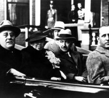
U.S. president Franklin D. Roosevelt and his wife, Eleanor Roosevelt, visit Atlanta in 1935, during the Great Depression. From left: Franklin D. and Eleanor Roosevelt, U.S. senator Walter F. George, and U.S. senator Richard B. Russell Jr.
The New Georgia Encyclopedia does not hold the copyright for this media resource and can neither grant nor deny permission to republish or reproduce the image online or in print. Requests for permission to publish or reproduce the resource may need to be submitted to the Richard B. Russell Library for Political Research and Studies at the University of Georgia.
Georgia aviation pioneer Ben Epps is pictured with his first airplane outside his garage in Athens, 1907.
Courtesy of Georgia Archives, Vanishing Georgia, #
clr176-83.
The New Georgia Encyclopedia does not hold the copyright for this media resource and can neither grant nor deny permission to republish or reproduce the image online or in print. Requests for permission to publish or reproduce the resource should be submitted to the Georgia Archives.
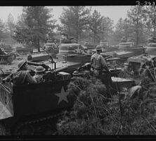
U.S. soldiers, pictured in the spring of 1942, undergo training at Fort Benning in Columbus. During World War II Fort Benning was the largest infantry training post in the world.
Courtesy of Library of Congress, Prints and Photographs Division
The New Georgia Encyclopedia does not hold the copyright for this media resource and can neither grant nor deny permission to republish or reproduce the image online or in print. All requests for permission to publish or reproduce the resource must be submitted to the rights holder.
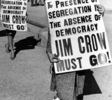
Students protest segregation at the state capitol building in Atlanta on February 1, 1962. The passage of the federal Civil Rights Act in 1964 and the Voting Rights Act in 1965 ended legal segregation across the nation.
Courtesy of Atlanta Journal-Constitution.
The New Georgia Encyclopedia does not hold the copyright for this media resource and can neither grant nor deny permission to republish or reproduce the image online or in print. All requests for permission to publish or reproduce the resource must be submitted to the Atlanta Journal-Constitution.
Reporters gather at Atlanta's city hall on August 30, 1961, the day that the city's schools were officially integrated. The recommendations of the Sibley Commission to the state legislature in 1960 contributed to the desegregation of schools across Georgia.
Courtesy of Special Collections & Archives, Georgia State University Library, Lane Brothers Commercial Photographers Photographic Collection.
The New Georgia Encyclopedia does not hold the copyright for this media resource and can neither grant nor deny permission to republish or reproduce the image online or in print. Requests for permission to publish or reproduce the resource should be submitted to Special Collections and Archives at Georgia State University.
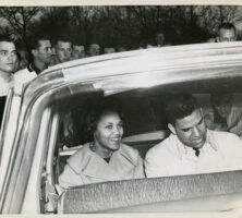
Charlayne Hunter and Hamilton Holmes, the first Black students to enroll at the University of Georgia, are pictured here at the end of their first day on campus in January 1961.
Courtesy of Atlanta Journal-Constitution.
The New Georgia Encyclopedia does not hold the copyright for this media resource and can neither grant nor deny permission to republish or reproduce the image online or in print. All requests for permission to publish or reproduce the resource must be submitted to the Atlanta Journal-Constitution.
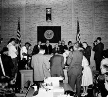
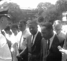
Martin Luther King Jr. (second from right) and Ralph David Abernathy (third from right) pray during their arrest in Albany on July 27, 1962. William G. Anderson, the president of the Albany Movement, asked King and Abernathy to help with efforts to desegregate the city.
The New Georgia Encyclopedia does not hold the copyright for this media resource and can neither grant nor deny permission to republish or reproduce the image online or in print. All requests for permission to publish or reproduce the resource must be submitted to the Walter J. Brown Media Archives and Peabody Awards Collection.
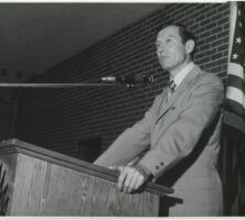
Augusta native Carl Sanders, elected governor of Georgia in 1962, brought the state into compliance with federal civil rights law during his single term in office.
The New Georgia Encyclopedia does not hold the copyright for this media resource and can neither grant nor deny permission to republish or reproduce the image online or in print. Requests for permission to publish or reproduce the resource should be submitted to the Hargrett Manuscript and Rare Book Library at the University of Georgia.
In 1966 Lester Maddox defeated former governor Ellis Arnall in the Democratic gubernatorial primary in a major political upset. Subsequently, as a result of a close race between Maddox and Republican Bo Callaway, the General Assembly chose Maddox as governor.
The New Georgia Encyclopedia does not hold the copyright for this media resource and can neither grant nor deny permission to republish or reproduce the image online or in print. Requests for permission to publish or reproduce the resource may need to be submitted to the Richard B. Russell Library for Political Research and Studies at the University of Georgia.
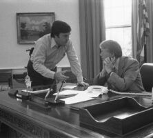
U.S. president Jimmy Carter (right) meets with Hamilton Jordan in the Oval Office of the White House in 1977. Jordan served as Carter's chief of staff from 1977 to 1980.
Courtesy of Jimmy Carter Presidential Library and Museum.
The New Georgia Encyclopedia does not hold the copyright for this media resource and can neither grant nor deny permission to republish or reproduce the image online or in print. Requests for permission to publish or reproduce the resource may need to be submitted to the Jimmy Carter Presidential Library and Museum.
The New Georgia Encyclopedia does not hold the copyright for this media resource and can neither grant nor deny permission to republish or reproduce the image online or in print. All requests for permission to publish or reproduce the resource must be submitted to the rights holder.
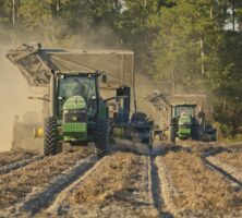
Georgia farmers lead the United States in peanut production, raising approximately 45 percent of the nation's total harvest. Grown in most south Georgia counties, peanuts are the official state crop.
Courtesy of Explore Georgia, Photograph by Ralph Daniel.
The New Georgia Encyclopedia does not hold the copyright for this media resource and can neither grant nor deny permission to republish or reproduce the image online or in print. Requests for permission to publish or reproduce the resource may need to be submitted to Explore Georgia.
The New Georgia Encyclopedia does not hold the copyright for this media resource and can neither grant nor deny permission to republish or reproduce the image online or in print. All requests for permission to publish or reproduce the resource must be submitted to the rights holder.
Latino workers plant loblolly pine seedlings in 1999 near Bremen, in Haralson County. Latino immigrants came to Georgia in large numbers during the 1980s and 1990s to work in the agriculture, construction, carpet, and poultry processing industries.
Courtesy of Atlanta Journal-Constitution.
The New Georgia Encyclopedia does not hold the copyright for this media resource and can neither grant nor deny permission to republish or reproduce the image online or in print. All requests for permission to publish or reproduce the resource must be submitted to the Atlanta Journal-Constitution.
Tourists on St. Simons Island gather outside one of the island's many shops. The island suffered an economic depression at the end of the cotton era in the 1830s, but its fortunes reversed with the arrival of the timber industry in the 1870s. Today St. Simons enjoys a strong tourist industry.
Courtesy of Explore Georgia.
The New Georgia Encyclopedia does not hold the copyright for this media resource and can neither grant nor deny permission to republish or reproduce the image online or in print. Requests for permission to publish or reproduce the resource may need to be submitted to Explore Georgia.
James Oglethorpe, a leader in the British movement to found a new colony in America, set sail for the new world on November 17, 1732, accompanied by Georgia's first settlers.
The New Georgia Encyclopedia does not hold the copyright for this media resource and can neither grant nor deny permission to republish or reproduce the image online or in print. Requests for permission to publish or reproduce the resource should be submitted to the Hargrett Manuscript and Rare Book Library at the University of Georgia.
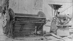
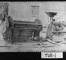
This roller gin, built by William Van Houten in Turner County, won first place at the Savannah State Fair in 1901. Farmers have continued to modify and improve Eli Whitney's original cotton gin since its invention in 1793.
Courtesy of Georgia Archives, Vanishing Georgia, #
tur001.
The New Georgia Encyclopedia does not hold the copyright for this media resource and can neither grant nor deny permission to republish or reproduce the image online or in print. Requests for permission to publish or reproduce the resource should be submitted to the Georgia Archives.
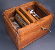
An original model of an Eli Whitney cotton gin (circa 1800) is on display in Washington, D.C., at the National Museum of American History.
Image from National Museum of American History, Smithsonian Institution
The New Georgia Encyclopedia does not hold the copyright for this media resource and can neither grant nor deny permission to republish or reproduce the image online or in print. All requests for permission to publish or reproduce the resource must be submitted to the rights holder.
Catharine Greene was the noted wife of Revolutionary War general Nathanael Greene and later a supporter of Eli Whitney, the inventor of the cotton gin. This painting of Greene (oil on panel, 32 3/4" x 25 3/4"), dated circa 1809, is attributed to James Frothingham.
Courtesy of Telfair Museums.
The New Georgia Encyclopedia does not hold the copyright for this media resource and can neither grant nor deny permission to republish or reproduce the image online or in print. All requests for permission to publish or reproduce the resource must be submitted to Telfair Museums.
The New Georgia Encyclopedia does not hold the copyright for this media resource and can neither grant nor deny permission to republish or reproduce the image online or in print. All requests for permission to publish or reproduce the resource must be submitted to the rights holder.
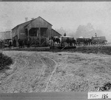
The Dykes Creek Cotton Gin, pictured circa 1890, was located on Kingston Road in Rome. In the decades after the Civil War, cotton farmers brought their cotton to a community gin, rather than installing cotton gins on their own property.
Courtesy of Georgia Archives, Vanishing Georgia, #flo136.
The New Georgia Encyclopedia does not hold the copyright for this media resource and can neither grant nor deny permission to republish or reproduce the image online or in print. Requests for permission to publish or reproduce the resource should be submitted to the Georgia Archives.
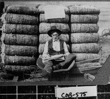
James Marion Prance, the proprietor of a cotton gin in Cobb County, is pictured sitting in front of bales of cotton in the early 1900s.
Courtesy of Georgia Archives, Vanishing Georgia, #
cob575.
The New Georgia Encyclopedia does not hold the copyright for this media resource and can neither grant nor deny permission to republish or reproduce the image online or in print. Requests for permission to publish or reproduce the resource should be submitted to the Georgia Archives.
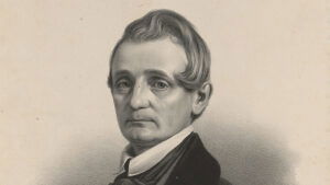
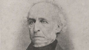
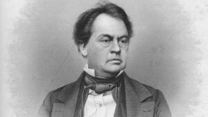
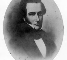
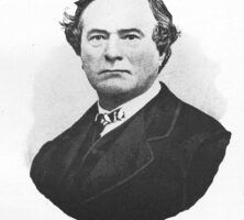
Oliver H. Prince, a native of Connecticut, had a varied career in Georgia, which included stints as a lawyer, state and U.S. senator, journalist, and humorist. He was also instrumental in the founding of Macon and in bringing railroads to the state.
The New Georgia Encyclopedia does not hold the copyright for this media resource and can neither grant nor deny permission to republish or reproduce the image online or in print. Requests for permission to publish or reproduce the resource should be submitted to the Hargrett Manuscript and Rare Book Library at the University of Georgia.
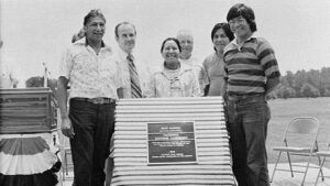
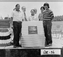
Cherokee Indian leaders pose in 1976 next to a plaque dedicating New Echota as a National Historic Landmark. Located northeast of Calhoun, New Echota was the capital of the Cherokee Nation.
Courtesy of Georgia Archives, Vanishing Georgia, #
gor036.
The New Georgia Encyclopedia does not hold the copyright for this media resource and can neither grant nor deny permission to republish or reproduce the image online or in print. Requests for permission to publish or reproduce the resource should be submitted to the Georgia Archives.
The New Georgia Encyclopedia does not hold the copyright for this media resource and can neither grant nor deny permission to republish or reproduce the image online or in print. All requests for permission to publish or reproduce the resource must be submitted to the rights holder.
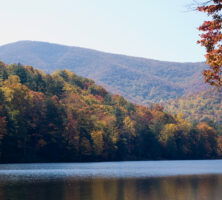
Blood Mountain, at 4,461 feet, is the highest peak along the Appalachian Trail in Georgia and the sixth highest mountain in the state. The mountain is located near the line between Union and Lumpkin counties and may have been named for a battle between the Cherokees and the Creeks.
Photograph by Sammy Hancock
The New Georgia Encyclopedia does not hold the copyright for this media resource and can neither grant nor deny permission to republish or reproduce the image online or in print. All requests for permission to publish or reproduce the resource must be submitted to the rights holder.
The New Georgia Encyclopedia does not hold the copyright for this media resource and can neither grant nor deny permission to republish or reproduce the image online or in print. All requests for permission to publish or reproduce the resource must be submitted to the rights holder.
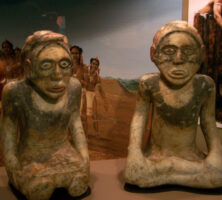
Archaeological excavation, carried out intermittently at the Etowah mound site for more than 100 years, has unearthed artifacts such as these figures, which have provided much information about life in the Mississippian Period.
Photograph from Wikimedia
The New Georgia Encyclopedia does not hold the copyright for this media resource and can neither grant nor deny permission to republish or reproduce the image online or in print. All requests for permission to publish or reproduce the resource must be submitted to the rights holder.
The New Georgia Encyclopedia does not hold the copyright for this media resource and can neither grant nor deny permission to republish or reproduce the image online or in print. All requests for permission to publish or reproduce the resource must be submitted to the rights holder.
The New Georgia Encyclopedia does not hold the copyright for this media resource and can neither grant nor deny permission to republish or reproduce the image online or in print. All requests for permission to publish or reproduce the resource must be submitted to the rights holder.
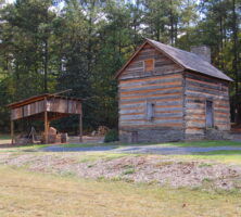
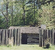
The Fort Yargo cabin was built by whites in 1792 for protection against the Creeks and the Cherokees. Today it is used for history encampments at Fort Yargo State Park.
Photograph by Ashley Farrow, Wikimedia Commons
The New Georgia Encyclopedia does not hold the copyright for this media resource and can neither grant nor deny permission to republish or reproduce the image online or in print. All requests for permission to publish or reproduce the resource must be submitted to the rights holder.
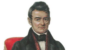
As principal chief of the Cherokee Nation, John Ross struggled until 1838 against the removal of the Cherokees from the Southeast. Beginning in 1838, however, he was forced to lead the Cherokees through the tragic removal period, which culminated in the Trail of Tears. He remained principal chief until his death in 1866.
The New Georgia Encyclopedia does not hold the copyright for this media resource and can neither grant nor deny permission to republish or reproduce the image online or in print. Requests for permission to publish or reproduce the resource should be submitted to the Hargrett Manuscript and Rare Book Library at the University of Georgia.
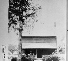
The Oothcaloga Moravian Mission provided education and religious instruction to Cherokees from 1822 to 1833. Operated by the Moravian Church, the mission was located in present-day Gordon County. By 1833 whites occupied the house, following the land lottery of 1832.
Courtesy of Georgia Archives, Vanishing Georgia, #gor322.
The New Georgia Encyclopedia does not hold the copyright for this media resource and can neither grant nor deny permission to republish or reproduce the image online or in print. Requests for permission to publish or reproduce the resource should be submitted to the Georgia Archives.
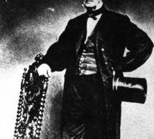
John D. Gray was the first major railroad contractor in the South and served as president of the Monroe Railroad in Georgia. During the Civil War he manufactured weaponry for the Confederacy.
Courtesy of Nancy Eubanks
The New Georgia Encyclopedia does not hold the copyright for this media resource and can neither grant nor deny permission to republish or reproduce the image online or in print. All requests for permission to publish or reproduce the resource must be submitted to the rights holder.
Colonel Francis S. Bartow was killed in July 1861 during a Civil War battle at Manassas, Virginia. He was the first high-ranking Georgia military officer to die in the war. Before his death, Bartow advocated for secession and became one of the leaders of the new Confederate government. His portrait was painted by Willis Pepoon.
Courtesy of Georgia Historical Society, Georgia Historical Society collection of portraits, #GHS 1361-320.
The New Georgia Encyclopedia does not hold the copyright for this media resource and can neither grant nor deny permission to republish or reproduce the image online or in print. All requests for permission to publish or reproduce the resource must be submitted to Georgia Historical Society.
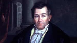
Garnett Andrews was appointed judge of the Northern Circuit of the Superior Court of Georgia in 1834. He later served in the state House of Representatives and, on the eve of the Civil War, was a vocal opponent of secession. The portrait was painted in the early 1830s.
Courtesy of Rosalie Andrews McConnell
The New Georgia Encyclopedia does not hold the copyright for this media resource and can neither grant nor deny permission to republish or reproduce the image online or in print. All requests for permission to publish or reproduce the resource must be submitted to the rights holder.
The New Georgia Encyclopedia does not hold the copyright for this media resource and can neither grant nor deny permission to republish or reproduce the image online or in print. All requests for permission to publish or reproduce the resource must be submitted to the rights holder.
As a U.S. naval officer, Josiah Tattnall traveled around the world during the 1840s and 1850s. After the Civil War began, he was commissioned as a captain in the Confederate navy, with command of the Georgia and South Carolina coasts.
Image from U.S. Naval Historical Center Photograph
The New Georgia Encyclopedia does not hold the copyright for this media resource and can neither grant nor deny permission to republish or reproduce the image online or in print. All requests for permission to publish or reproduce the resource must be submitted to the rights holder.
William Harris Crawford, a longtime resident of Oglethorpe County, became the first Georgian to run for the U.S. presidency when he stood for election in both 1816 and 1824. Although never elected president, Crawford served in a variety of other capacities during his political career, including service as a state representative, U.S. senator, minister to France, and cabinet member for U.S. president James Madison.
Courtesy of Department of the Treasury
The New Georgia Encyclopedia does not hold the copyright for this media resource and can neither grant nor deny permission to republish or reproduce the image online or in print. All requests for permission to publish or reproduce the resource must be submitted to the rights holder.
The building that housed the State's Rights Hotel in Milledgeville was designed in the Federal style by John Marlor and completed in 1825. The structure was probably used as a tavern until 1837, when the building was sold. The hotel opened about two years later and became a center of political activity for several years.
Courtesy of Georgia's Old Capital Museum
The New Georgia Encyclopedia does not hold the copyright for this media resource and can neither grant nor deny permission to republish or reproduce the image online or in print. All requests for permission to publish or reproduce the resource must be submitted to the rights holder.
The New Georgia Encyclopedia does not hold the copyright for this media resource and can neither grant nor deny permission to republish or reproduce the image online or in print. All requests for permission to publish or reproduce the resource must be submitted to the rights holder.
The Brown-Stetson-Sanford House in Milledgeville, the former home of the State's Rights Hotel, was moved from its original location on North Wilkinson Street to West Hancock Street in 1966. Today the home, pictured in 2006, houses a museum and civic center operated by the Old Capital Museum.
Courtesy of Georgia's Old Capital Museum
The New Georgia Encyclopedia does not hold the copyright for this media resource and can neither grant nor deny permission to republish or reproduce the image online or in print. All requests for permission to publish or reproduce the resource must be submitted to the rights holder.
As a U.S. senator, John Macpherson Berrien distinguished himself as an eloquent debater. The U.S. Supreme Court chief justice John Marshall dubbed him "the honey-tongued Georgia youth." Engraving is by J. C. Buttre from a daguerreotype.
Courtesy of Hargrett Rare Book and Manuscript Library, University of Georgia Libraries, Georgia Photo File.
The New Georgia Encyclopedia does not hold the copyright for this media resource and can neither grant nor deny permission to republish or reproduce the image online or in print. Requests for permission to publish or reproduce the resource should be submitted to the Hargrett Manuscript and Rare Book Library at the University of Georgia.
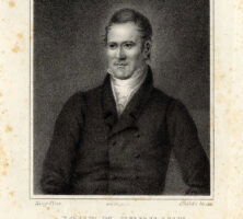
John Macpherson Berrien, pictured circa 1830, served as a state senator, a U.S. senator, and the attorney general of the United States under President Andrew Jackson. A native of New Jersey, Berrien spent much of his life in Savannah.
Courtesy of Hargrett Rare Book and Manuscript Library, University of Georgia Libraries, Georgia Photo File.
The New Georgia Encyclopedia does not hold the copyright for this media resource and can neither grant nor deny permission to republish or reproduce the image online or in print. Requests for permission to publish or reproduce the resource should be submitted to the Hargrett Manuscript and Rare Book Library at the University of Georgia.
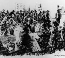
Cherokee land lots were parceled out to white Georgians in one of the two state land lotteries held in 1832. The state conducted a total of eight lotteries between 1805 and 1833. Sketch by George I. Parrish Jr., circa 1832.
Artwork by George I. Parrish Jr. Courtesy of Cindy Parrish, Maryville,TN
The New Georgia Encyclopedia does not hold the copyright for this media resource and can neither grant nor deny permission to republish or reproduce the image online or in print. All requests for permission to publish or reproduce the resource must be submitted to the rights holder.
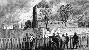
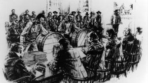
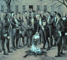
The burning of the Yazoo Act, which resulted in the Yazoo land fraud of 1795, took place on the grounds of the capitol building in Louisville. Louisville served as the state capital from 1796 until 1806, when the legislature moved to Milledgeville.
The New Georgia Encyclopedia does not hold the copyright for this media resource and can neither grant nor deny permission to republish or reproduce the image online or in print. All requests for permission to publish or reproduce the resource must be submitted to the rights holder.
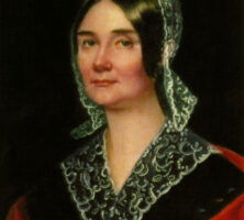
Mary Telfair, the daughter of Georgia governor Edward Telfair, bequeathed the family home in Savannah to found Telfair Museums, today the oldest public art museum in the South. Portrait by Enrichetta Narducci (1842), gouache on ivory, 3 1/8" x 2 3/4".
Courtesy of Telfair Museums.
The New Georgia Encyclopedia does not hold the copyright for this media resource and can neither grant nor deny permission to republish or reproduce the image online or in print. All requests for permission to publish or reproduce the resource must be submitted to Telfair Museums.
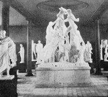
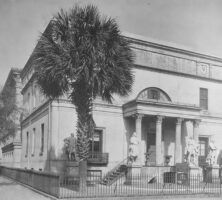
Sculptures donated by Mary Telfair grace the interior of the Telfair Academy of Arts and Sciences (later Telfair Museums) in Savannah, circa 1900. Telfair bequeathed the family home, designed by William Jay, for the establishment of the museum upon her death in 1875.
Courtesy of Georgia Archives, Vanishing Georgia, # ctm189.
The New Georgia Encyclopedia does not hold the copyright for this media resource and can neither grant nor deny permission to republish or reproduce the image online or in print. Requests for permission to publish or reproduce the resource should be submitted to the Georgia Archives.
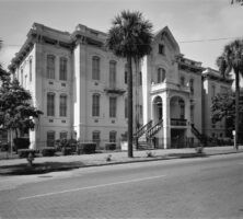
The Telfair Hospital for Females, in Savannah, was built in 1884 in the Italianate style by the architectural firm of Fay and Eichberg. Funding for the hospital was provided for in Mary Telfair's will, and by 1960, when it merged with Candler General Hospital, the facility had become the longest-operating women's hospital in the country.
Courtesy of Library of Congress, Prints and Photographs Division, Historic American Buildings Survey, Photograph by Walter Smalling Jr..
The New Georgia Encyclopedia does not hold the copyright for this media resource and can neither grant nor deny permission to republish or reproduce the image online or in print. All requests for permission to publish or reproduce the resource must be submitted to the rights holder.
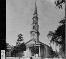
Independent Presbyterian Church in Savannah, pictured circa 1930, counted Mary Telfair, the benefactor of Telfair Museums, as a member in the nineteenth century. U.S. first lady Ellen Axson Wilson, whose paternal grandfather began serving as pastor in 1857, was born in the manse of the church in 1860 and married there in 1885.
Courtesy of Georgia Archives, Vanishing Georgia, #
ctm159.
The New Georgia Encyclopedia does not hold the copyright for this media resource and can neither grant nor deny permission to republish or reproduce the image online or in print. Requests for permission to publish or reproduce the resource should be submitted to the Georgia Archives.
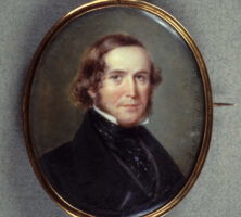
William Brown Hodgson married into the prominent Telfair family of Savannah in 1842 and, in addition to managing the family plantations, became an important figure in the city's intellectual life. Watercolor-on-ivory miniature portrait (1842) by Ernest J. A. Girard.
Courtesy of Telfair Museums.
The New Georgia Encyclopedia does not hold the copyright for this media resource and can neither grant nor deny permission to republish or reproduce the image online or in print. All requests for permission to publish or reproduce the resource must be submitted to Telfair Museums.
This portrait of William Brown Hodgson, by artist Carl Brandt, was unveiled at the 1876 dedication ceremony for Hodsgon Hall in Savannah. The hall was built in Hodgson's memory by his wife, Margaret Telfair Hodgson, to house the Georgia Historical Society.
Courtesy of Georgia Historical Society, Georgia Historical Society collection of portraits, #GHS 1361-084.
The New Georgia Encyclopedia does not hold the copyright for this media resource and can neither grant nor deny permission to republish or reproduce the image online or in print. All requests for permission to publish or reproduce the resource must be submitted to Georgia Historical Society.
The New Georgia Encyclopedia does not hold the copyright for this media resource and can neither grant nor deny permission to republish or reproduce the image online or in print. All requests for permission to publish or reproduce the resource must be submitted to the rights holder.
Hodgson Hall, completed in 1875, stands at the northwest corner of Forsyth Park in Savannah and houses the Georgia Historical Society. The building was erected by Margaret Telfair Hodgson in honor of her husband, William Brown Hodgson, an active member and curator in the society.
Courtesy of Georgia Historical Society.
The New Georgia Encyclopedia does not hold the copyright for this media resource and can neither grant nor deny permission to republish or reproduce the image online or in print. All requests for permission to publish or reproduce the resource must be submitted to Georgia Historical Society.
Margaret Telfair was born into the prominent Telfair family of Savannah in 1797, and in 1842 she married William Hodgson in London, England. The couple lived in the Telfair mansion on St. James Square in Savannah until their deaths in the 1870s. Portrait attributed to Richard West Habersham, watercolor on ivory (1 7/8" x 1 1/2 "), ca. 1834-35.
Courtesy of Telfair Museums.
The New Georgia Encyclopedia does not hold the copyright for this media resource and can neither grant nor deny permission to republish or reproduce the image online or in print. All requests for permission to publish or reproduce the resource must be submitted to Telfair Museums.
Joseph Vann, the son of Cherokee chief James Vann, inherited his father's Spring Place Plantation in Murray County. Before being dispossessed of the plantation in 1834, Vann was a successful businessman and member of the Cherokee legislature.
Courtesy of Chief Vann House Historic Site
The New Georgia Encyclopedia does not hold the copyright for this media resource and can neither grant nor deny permission to republish or reproduce the image online or in print. All requests for permission to publish or reproduce the resource must be submitted to the rights holder.
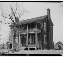
In 1834 Cherokee chief James Vann's son Joseph lost the family home to the state. The home was subsequently owned by seventeen people and had fallen into a state of disrepair before its 1952 purchase and restoration by the Georgia Historical Commission.
Courtesy of Library of Congress, Prints and Photographs Division
The New Georgia Encyclopedia does not hold the copyright for this media resource and can neither grant nor deny permission to republish or reproduce the image online or in print. All requests for permission to publish or reproduce the resource must be submitted to the rights holder.
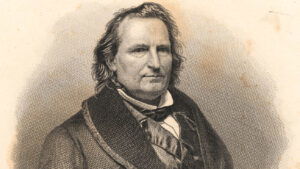
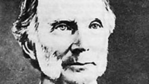
Eugenius Nisbet was one of the first three justices, along with Joseph Henry Lumpkin and Hiram Warner, to serve on the Supreme Court of Georgia upon its inception in 1845. Previously Nisbet had served as both a state representative and a U.S. congressman.
From Georgia Government and History, by A. B. Saye
The New Georgia Encyclopedia does not hold the copyright for this media resource and can neither grant nor deny permission to republish or reproduce the image online or in print. All requests for permission to publish or reproduce the resource must be submitted to the rights holder.
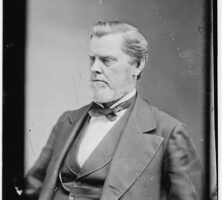
Benjamin Hill, a native of Japer County, served as a Georgia statesman for more than three decades. Hill began his political career in 1851 as a state representative, served as a Confederate senator during the Civil War, and won a seat in the U.S. Congress in 1875.
Courtesy of Library of Congress, Prints and Photographs Division
The New Georgia Encyclopedia does not hold the copyright for this media resource and can neither grant nor deny permission to republish or reproduce the image online or in print. All requests for permission to publish or reproduce the resource must be submitted to the rights holder.
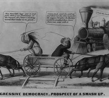
Republican candidate Abraham Lincoln, with running mate Hannibal Hamlin, steams toward a wagon named "Democratic Platform" that is trapped on the tracks between two teams of candidates. Stephen Douglas and Hershel Johnson pull toward the left, while John Breckinridge and Joseph Lane pull toward the right.
Courtesy of Library of Congress, Prints and Photographs Division
The New Georgia Encyclopedia does not hold the copyright for this media resource and can neither grant nor deny permission to republish or reproduce the image online or in print. All requests for permission to publish or reproduce the resource must be submitted to the rights holder.
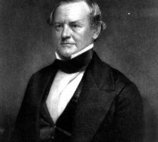
William Washington Gordon served the state in a variety of ways during the nineteenth century, including terms as both representative and senator in the Georgia legislature. Gordon also made significant contributions as the president of Central Railroad and Banking Company, which constructed the first rail line between Savannah and the state's interior.
Courtesy of Hargrett Rare Book and Manuscript Library, University of Georgia Libraries, Georgia Photo File.
The New Georgia Encyclopedia does not hold the copyright for this media resource and can neither grant nor deny permission to republish or reproduce the image online or in print. Requests for permission to publish or reproduce the resource should be submitted to the Hargrett Manuscript and Rare Book Library at the University of Georgia.
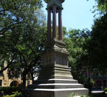
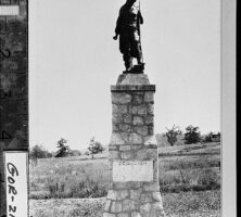
The monument to William Washington Gordon, builder of the state's first railroad, is situated on Wright Square in Savannah. Erected in 1883, the monument was designed by Henry Van Brunt and Frank M. Howe.
Image from Ken Lund
The New Georgia Encyclopedia does not hold the copyright for this media resource and can neither grant nor deny permission to republish or reproduce the image online or in print. All requests for permission to publish or reproduce the resource must be submitted to the rights holder.
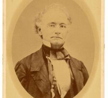
Henry Cumming, a native of Augusta, is best remembered for his pioneering vision of and support for the Augusta Canal, which was completed in 1846. In 1822 Cumming opened a law practice in Augusta with George Crawford, who would become governor of the state in 1843.
Courtesy of David Connolly
The New Georgia Encyclopedia does not hold the copyright for this media resource and can neither grant nor deny permission to republish or reproduce the image online or in print. All requests for permission to publish or reproduce the resource must be submitted to the rights holder.
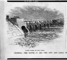
This sketch of the Augusta Canal, a project championed and partially funded by Augusta attorney Henry Cumming, was made in 1880.
Courtesy of Library of Congress, Prints and Photographs Division
The New Georgia Encyclopedia does not hold the copyright for this media resource and can neither grant nor deny permission to republish or reproduce the image online or in print. All requests for permission to publish or reproduce the resource must be submitted to the rights holder.
George W. Crawford was the first and only Whig to be elected governor of Georgia. He served two terms, from 1843 to 1847. A native of Columbia County, Crawford also served as a state representative and as Georgia's attorney general.
From The History of the State of Georgia, by I. W. Avery
The New Georgia Encyclopedia does not hold the copyright for this media resource and can neither grant nor deny permission to republish or reproduce the image online or in print. All requests for permission to publish or reproduce the resource must be submitted to the rights holder.
Built in 1845 by Henry Cumming, the Augusta canal is seven miles long, extending from above the rapids of the Savannah River to the heart of Augusta. In 1996 the canal was designated a National Heritage Area, the first site in Georgia to receive this designation.
Image from TranceMist
The New Georgia Encyclopedia does not hold the copyright for this media resource and can neither grant nor deny permission to republish or reproduce the image online or in print. All requests for permission to publish or reproduce the resource must be submitted to the rights holder.
Preservationists in Georgia are working to conserve both the Savannah-Ogeechee Canal and the Augusta Canal. The Augusta Canal was named a National Heritage Area in 1996.
Courtesy of Explore Georgia, Photograph by Ralph Daniel.
The New Georgia Encyclopedia does not hold the copyright for this media resource and can neither grant nor deny permission to republish or reproduce the image online or in print. Requests for permission to publish or reproduce the resource may need to be submitted to Explore Georgia.
The New Georgia Encyclopedia does not hold the copyright for this media resource and can neither grant nor deny permission to republish or reproduce the image online or in print. All requests for permission to publish or reproduce the resource must be submitted to the rights holder.
The Augusta Canal, designed to generate waterpower for manufacturing as Georgia entrepreneurs attempted to diversify the state's economy, was the last canal built in Georgia and by far the most successful. Construction on the canal started in 1844, and the canal became operational in 1846.
Courtesy of Explore Georgia, Photograph by Ralph Daniel.
The New Georgia Encyclopedia does not hold the copyright for this media resource and can neither grant nor deny permission to republish or reproduce the image online or in print. Requests for permission to publish or reproduce the resource may need to be submitted to Explore Georgia.
The Augusta Factory, a cotton mill, was powered by the Augusta Canal during the 1890s. The factory was built in 1847 and demolished in 1960.
Courtesy of Georgia Archives, Vanishing Georgia, #
ric002.
The New Georgia Encyclopedia does not hold the copyright for this media resource and can neither grant nor deny permission to republish or reproduce the image online or in print. Requests for permission to publish or reproduce the resource should be submitted to the Georgia Archives.
The Confederate Powder Works in Augusta sits along the Augusta Canal. The canal, which opened in 1846, provided transportation and waterpower during the Civil War for the powder works, as well as for a Confederate firearms plant, ordnance foundry, and bakery.
Courtesy of Library of Congress, Prints and Photographs Division
The New Georgia Encyclopedia does not hold the copyright for this media resource and can neither grant nor deny permission to republish or reproduce the image online or in print. All requests for permission to publish or reproduce the resource must be submitted to the rights holder.
A modern tourboat passes the Confederate Powder Works chimney in Augusta along the Augusta Canal. The Georgia Community Greenspace Program has worked to preserve the Augusta Canal as an important historic and archaeological site.
Courtesy of Explore Georgia, Photograph by Ralph Daniel.
The New Georgia Encyclopedia does not hold the copyright for this media resource and can neither grant nor deny permission to republish or reproduce the image online or in print. Requests for permission to publish or reproduce the resource may need to be submitted to Explore Georgia.
This oil portrait of Alexander Telfair (30 1/8" x 64 1/4") was made around 1830. Telfair assumed control of his family's considerable plantation and business operations around 1818, following the deaths of his brothers, Josiah and Thomas Telfair.
Courtesy of Telfair Museums.
The New Georgia Encyclopedia does not hold the copyright for this media resource and can neither grant nor deny permission to republish or reproduce the image online or in print. All requests for permission to publish or reproduce the resource must be submitted to Telfair Museums.
The Telfair mansion, commissioned by Alexander Telfair and designed by renowned architect William Jay, was completed in 1819. Telfair's sister Mary Telfair left the home to the Georgia Historical Society upon her death in 1875, and today the mansion houses the Telfair Academy of the Telfair Museums in Savannah.
Courtesy of Georgia Archives, Vanishing Georgia, # ctm156.
The New Georgia Encyclopedia does not hold the copyright for this media resource and can neither grant nor deny permission to republish or reproduce the image online or in print. Requests for permission to publish or reproduce the resource should be submitted to the Georgia Archives.
Sarah Gibbons was born into one of the wealthiest families in the Georgia colony. In 1774 she married Edward Telfair, a prominent planter and merchant in Savannah, and the couple had seven children who survived infancy. Portrait by unknown artist, oil on board (8 1/4" x 7"), date unknown.
Courtesy of Telfair Museums.
The New Georgia Encyclopedia does not hold the copyright for this media resource and can neither grant nor deny permission to republish or reproduce the image online or in print. All requests for permission to publish or reproduce the resource must be submitted to Telfair Museums.
Hiram Warner, a native of Massachusetts, moved to Georgia in 1822 at the age of twenty to teach in Hancock County. He subsequently practiced law and won election to both the state legislature and the U.S. Congress during his long political career. In 1867 Warner was appointed the second chief justice of the Supreme Court of Georgia.
From The History of the State of Georgia, by I. W. Avery
The New Georgia Encyclopedia does not hold the copyright for this media resource and can neither grant nor deny permission to republish or reproduce the image online or in print. All requests for permission to publish or reproduce the resource must be submitted to the rights holder.
Hiram Warner, pictured here between 1870 and 1880, was appointed the second chief justice of the Supreme Court of Georgia in 1867 and served for one year. In 1872 Warner returned for another term as chief justice, serving until 1880. Of his 2,000 written opinions, many continue to influence the interpretation of Georgia law today.
Courtesy of Library of Congress, Prints and Photographs Division
The New Georgia Encyclopedia does not hold the copyright for this media resource and can neither grant nor deny permission to republish or reproduce the image online or in print. All requests for permission to publish or reproduce the resource must be submitted to the rights holder.
Hopkins Holsey was appointed to finish James C. Terrell's term in the U.S. Congress in 1835 and served as a representative from Georgia until 1838. In 1838 he moved to Athens, where in 1846 he bought the Southern Banner, a local newspaper.
Photograph by Mathew B. Brady. Courtesy of National Archives and Records Administration
The New Georgia Encyclopedia does not hold the copyright for this media resource and can neither grant nor deny permission to republish or reproduce the image online or in print. All requests for permission to publish or reproduce the resource must be submitted to the rights holder.
After graduation from the University of Georgia, Thomas R. R. Cobb practiced law and wrote several significant legal works, including a defense of slavery called An Inquiry into the Law of Negro Slavery in the United States of America (1858). Cobb and his brother Howell campaigned around Georgia for secession following the election of Abraham Lincoln in 1860.
Courtesy of Hargrett Rare Book and Manuscript Library, University of Georgia Libraries, Georgia Photo File.
The New Georgia Encyclopedia does not hold the copyright for this media resource and can neither grant nor deny permission to republish or reproduce the image online or in print. Requests for permission to publish or reproduce the resource should be submitted to the Hargrett Manuscript and Rare Book Library at the University of Georgia.
Thomas R. R. Cobb, an antebellum legal authority and Confederate general, was born in Jefferson County but spent most of his life in Athens. He graduated at the top of his class from the University of Georgia and in 1844 married Marion Lumpkin, the daughter of prominent judge Joseph Henry Lumpkin.
Courtesy of Hargrett Rare Book and Manuscript Library, University of Georgia Libraries, Georgia Photo File.
The New Georgia Encyclopedia does not hold the copyright for this media resource and can neither grant nor deny permission to republish or reproduce the image online or in print. Requests for permission to publish or reproduce the resource should be submitted to the Hargrett Manuscript and Rare Book Library at the University of Georgia.
Following Georgia's secession from the Union in 1861, Howell Cobb served as president of the Confederate Provisional Congress (1861-62) and a major general of the Confederate army.
Courtesy of Hargrett Rare Book and Manuscript Library, University of Georgia Libraries, Georgia Photo File.
The New Georgia Encyclopedia does not hold the copyright for this media resource and can neither grant nor deny permission to republish or reproduce the image online or in print. Requests for permission to publish or reproduce the resource should be submitted to the Hargrett Manuscript and Rare Book Library at the University of Georgia.
The Lucy Cobb Institute, a secondary school for young women in Athens, was founded in 1859 by Thomas R. R. Cobb, a prominent lawyer and proslavery writer.
Courtesy of Georgia Archives, Vanishing Georgia, # clr053.
The New Georgia Encyclopedia does not hold the copyright for this media resource and can neither grant nor deny permission to republish or reproduce the image online or in print. Requests for permission to publish or reproduce the resource should be submitted to the Georgia Archives.
The historic T. R. R. Cobb house, built in Athens in 1839, was moved to Stone Mountain in 1985. The home was returned in 2004 to Athens and situated two blocks from its original location. Restored by the Watson-Brown Foundation, the home opened in 2007 as a house museum and conference site.
Photograph by Sarah E. McKee, New Georgia Encyclopedia
The New Georgia Encyclopedia does not hold the copyright for this media resource and can neither grant nor deny permission to republish or reproduce the image online or in print. All requests for permission to publish or reproduce the resource must be submitted to the rights holder.
Although Chief Justice John Marshall ruled in Cherokee Nation v. Georgia (1831) that the Cherokees should receive the protection of the U.S. government, the state of Georgia continued to encroach upon Cherokee lands.
Photograph by Wikimedia
The New Georgia Encyclopedia does not hold the copyright for this media resource and can neither grant nor deny permission to republish or reproduce the image online or in print. All requests for permission to publish or reproduce the resource must be submitted to the rights holder.
This hand-colored lithograph of Sequoyah (also called George Gist or George Guess), the legendary creator of the Cherokee syllabary, was made in 1833 after an oil portrait by Charles Bird King as part of a series depicting Native American leaders.
From The Indian Tribes of North America, by T. L. McKenney and J. Hall
The New Georgia Encyclopedia does not hold the copyright for this media resource and can neither grant nor deny permission to republish or reproduce the image online or in print. All requests for permission to publish or reproduce the resource must be submitted to the rights holder.
This portrait by Charles Bird King shows John Ross at his prime. A well-educated and successful businessman, John Ross helped to establish the Cherokee Nation's first government and became principal chief in 1827.
Print by Charles Bird King. From History of the Indian Tribes of North America, by T. McKenney and J. Hall
The New Georgia Encyclopedia does not hold the copyright for this media resource and can neither grant nor deny permission to republish or reproduce the image online or in print. All requests for permission to publish or reproduce the resource must be submitted to the rights holder.
Hand-colored lithograph of Major Ridge, a Cherokee leader who helped establish the Cherokee system of government. The soldier, politician, and plantation owner is remembered for signing the Treaty of New Echota (1835), which ceded Cherokee lands to the U.S. government and authorized Cherokee removal.
From History of the Indian Tribes of North America, by T. McKenney and J. Hall
The New Georgia Encyclopedia does not hold the copyright for this media resource and can neither grant nor deny permission to republish or reproduce the image online or in print. All requests for permission to publish or reproduce the resource must be submitted to the rights holder.
A lifelong politician, Alexander Stephens is perhaps best remembered as the vice president of the Confederacy during the Civil War.
Courtesy of National Portrait Gallery, Smithsonian Institute
The New Georgia Encyclopedia does not hold the copyright for this media resource and can neither grant nor deny permission to republish or reproduce the image online or in print. All requests for permission to publish or reproduce the resource must be submitted to the rights holder.
Alexander Stephens was selected in 1866 by the Georgia legislature to represent the state, along with Herschel Johnson, in the U.S. Senate. Because he had served as vice president of the Confederacy, however, the Senate did not allow Stephens to take his seat.
The New Georgia Encyclopedia does not hold the copyright for this media resource and can neither grant nor deny permission to republish or reproduce the image online or in print. All requests for permission to publish or reproduce the resource must be submitted to the rights holder.
Alexander Stephens, the Confederate vice president and a Georgia native, was a master at managing relations with journalists, and he used his stable of press supporters, including the Augusta Chronicle and Sentinel and the Southern Confederacy of Atlanta, to spread his peace doctrine.
Courtesy of Hargrett Rare Book and Manuscript Library, University of Georgia Libraries, Georgia Photo File.
The New Georgia Encyclopedia does not hold the copyright for this media resource and can neither grant nor deny permission to republish or reproduce the image online or in print. Requests for permission to publish or reproduce the resource should be submitted to the Hargrett Manuscript and Rare Book Library at the University of Georgia.
Alexander Stephens. After the Civil War Stephens was elected to the U.S. Senate, but that body refused to seat the former vice president of the Confederacy. He then was elected to the Georgia House of Representatives and finally as governor, an office he held for only a few months before he died.
Image from Clement Anselm Evans
The New Georgia Encyclopedia does not hold the copyright for this media resource and can neither grant nor deny permission to republish or reproduce the image online or in print. All requests for permission to publish or reproduce the resource must be submitted to the rights holder.
Liberty Hall in Taliaferro County, home of Alexander H. Stephens, is pictured in 1936.
Courtesy of Library of Congress, Prints and Photographs Division, Historic American Buildings Survey, #HABS GA,133-CRAWV,1--2.
The New Georgia Encyclopedia does not hold the copyright for this media resource and can neither grant nor deny permission to republish or reproduce the image online or in print. All requests for permission to publish or reproduce the resource must be submitted to the rights holder.
In this political cartoon, a Union officer (unidentified) swings a club labeled "Union" in defense against a many-headed serpent labeled "Secession." The serpent's heads are: Floyd, Pickens, Beauregard, Twiggs, Davis, Stephens, and Toombs, all leaders of the Southern secession movement and the resulting Confederacy.
Courtesy of Civil War Treasures, New York Historical Society
The New Georgia Encyclopedia does not hold the copyright for this media resource and can neither grant nor deny permission to republish or reproduce the image online or in print. All requests for permission to publish or reproduce the resource must be submitted to the rights holder.
The A. H. Stephens Historic Park, in Crawfordville, is part of the Georgia state park system. The park includes Alexander Stephens's restored home, Liberty Hall, as well a museum containing Civil War artifacts.
Courtesy of Georgia Department of Natural Resources, Photograph from Georgia State Parks.
The New Georgia Encyclopedia does not hold the copyright for this media resource and can neither grant nor deny permission to republish or reproduce the image online or in print. Requests for permission to publish or reproduce the resource may need to be submitted to the Georgia Department of Natural Resources.
Wilson Lumpkin served as governor of Georgia from 1831 to 1835. During his long political career, Lumpkin was also elected to office in the U.S. House and Senate and held the position of U.S. commissioner to the Cherokee Indians. Painting by J. T. Moore.
Courtesy of Georgia Capitol Tours
The New Georgia Encyclopedia does not hold the copyright for this media resource and can neither grant nor deny permission to republish or reproduce the image online or in print. All requests for permission to publish or reproduce the resource must be submitted to the rights holder.
Before embarking on his political career, Wilson Lumpkin also worked as a farmer and as a teacher. Upon his death in 1870, Lumpkin's daughter deeded his farm in Athens to the University of Georgia.
From The Removal of the Cherokee Indians from Georgia, by Wilson Lumpkin
The New Georgia Encyclopedia does not hold the copyright for this media resource and can neither grant nor deny permission to republish or reproduce the image online or in print. All requests for permission to publish or reproduce the resource must be submitted to the rights holder.
Ebos Landing is a bend in Dunbar Creek on St. Simons Island. Although conflicting accounts of the "Myth of the Flying Africans" exist, many locals designate this spot as the site from which a boatload of enslaved West Africans either flew away or drowned themselves during an 1803 rebellion.
Photograph by Elisabeth Hughes, New Georgia Encyclopedia
The New Georgia Encyclopedia does not hold the copyright for this media resource and can neither grant nor deny permission to republish or reproduce the image online or in print. All requests for permission to publish or reproduce the resource must be submitted to the rights holder.
Ebos Landing, pictured in 2004, was the site of an 1803 slave rebellion, during which a group of Ebo Africans drowned themselves rather than submit to slavery.
Photograph by Elisabeth Hughes, New Georgia Encyclopedia
The New Georgia Encyclopedia does not hold the copyright for this media resource and can neither grant nor deny permission to republish or reproduce the image online or in print. All requests for permission to publish or reproduce the resource must be submitted to the rights holder.
The New Georgia Encyclopedia does not hold the copyright for this media resource and can neither grant nor deny permission to republish or reproduce the image online or in print. All requests for permission to publish or reproduce the resource must be submitted to the rights holder.
The Okefenokee incursion of 1838-39, led by Charles Rinaldo Floyd, ultimately was deemed a success, not because of the defeat of the Seminoles within its borders but because, by virtue of entering the swamp, Floyd claimed its expanse for the state of Georgia.
Courtesy of Hargrett Rare Book and Manuscript Library, University of Georgia Libraries, Georgia Photo File.
The New Georgia Encyclopedia does not hold the copyright for this media resource and can neither grant nor deny permission to republish or reproduce the image online or in print. Requests for permission to publish or reproduce the resource should be submitted to the Hargrett Manuscript and Rare Book Library at the University of Georgia.
The New Georgia Encyclopedia does not hold the copyright for this media resource and can neither grant nor deny permission to republish or reproduce the image online or in print. All requests for permission to publish or reproduce the resource must be submitted to the rights holder.
Isabella Maria Hazzard was the mother of Charles Rinaldo Floyd, a militia leader during the Okefenokee Campaign of 1838-39.
Courtesy of Georgia Archives, Vanishing Georgia, # cam212.
The New Georgia Encyclopedia does not hold the copyright for this media resource and can neither grant nor deny permission to republish or reproduce the image online or in print. Requests for permission to publish or reproduce the resource should be submitted to the Georgia Archives.
The Georgia penitentiary in Milledgeville burning in 1864. The illustration appeared in Frank Leslie's Illustrated Newspaper, on January 14, 1865.
The New Georgia Encyclopedia does not hold the copyright for this media resource and can neither grant nor deny permission to republish or reproduce the image online or in print. Requests for permission to publish or reproduce the resource should be submitted to the Hargrett Manuscript and Rare Book Library at the University of Georgia.
Layout of the Georgia penitentiary in Milledgeville, circa 1860.
The New Georgia Encyclopedia does not hold the copyright for this media resource and can neither grant nor deny permission to republish or reproduce the image online or in print. Requests for permission to publish or reproduce the resource should be submitted to the Hargrett Manuscript and Rare Book Library at the University of Georgia.
This pen-and-ink drawing and watercolor by Henry Byam Martin depicts a slave market in Charleston, South Carolina, in 1833. An inscription on the original reads "Charleston S.C. 4th March 1833 'The land of the free & home of the brave.'"
Courtesy of Library and Archives Canada
The New Georgia Encyclopedia does not hold the copyright for this media resource and can neither grant nor deny permission to republish or reproduce the image online or in print. All requests for permission to publish or reproduce the resource must be submitted to the rights holder.
According to his testimony, the injuries sustained from a whipping by his overseer kept Peter, an enslaved man, bedridden for two months.
Courtesy of National Archives and Records Administration
The New Georgia Encyclopedia does not hold the copyright for this media resource and can neither grant nor deny permission to republish or reproduce the image online or in print. All requests for permission to publish or reproduce the resource must be submitted to the rights holder.
A row of slave cabins in Chatham County is pictured in 1934. Enslaved people fostered family relationships and communities in and among their quarters.
Photograph by Wikimedia
The New Georgia Encyclopedia does not hold the copyright for this media resource and can neither grant nor deny permission to republish or reproduce the image online or in print. All requests for permission to publish or reproduce the resource must be submitted to the rights holder.
In the same manner as their enslaved ancestors, women on Sapelo Island hull rice with a mortar and pestle, circa 1925. Language and cultural traditions from West Africa were retained in the Geechee culture that developed in the Sea Islands.
Courtesy of Georgia Archives, Vanishing Georgia, #
sap093.
The New Georgia Encyclopedia does not hold the copyright for this media resource and can neither grant nor deny permission to republish or reproduce the image online or in print. Requests for permission to publish or reproduce the resource should be submitted to the Georgia Archives.
Thomas Nast's famous wood engraving originally appeared in Harper's Weekly on January 24, 1863. The liberation of the state's enslaved population, numbering more than 400,000, began during the chaos of the Civil War and continued well into 1865. Nast's cartoon aimed to arouse sympathy for freedpeople following emancipation.
From Harper's Weekly
The New Georgia Encyclopedia does not hold the copyright for this media resource and can neither grant nor deny permission to republish or reproduce the image online or in print. All requests for permission to publish or reproduce the resource must be submitted to the rights holder.
Antebellum towns including Macon, Milledgeville, Madison, and Greensboro experimented with steam-powered cotton factories, with varying degrees of success. The steam-powered factories in Madison and Greensboro went broke in the 1850s, while those in Milledgeville and Macon survived to serve the Confederacy.
The New Georgia Encyclopedia does not hold the copyright for this media resource and can neither grant nor deny permission to republish or reproduce the image online or in print. All requests for permission to publish or reproduce the resource must be submitted to the rights holder.
At the end of the 1820s Augustin Smith Clayton of Athens constructed a cotton mill near his hometown, hoping to prove the protective tariff that subsidized northern industry at the expense of southerners unnecessary.
Courtesy of Hargrett Rare Book and Manuscript Library, University of Georgia Libraries, Georgia Photo File.
The New Georgia Encyclopedia does not hold the copyright for this media resource and can neither grant nor deny permission to republish or reproduce the image online or in print. Requests for permission to publish or reproduce the resource should be submitted to the Hargrett Manuscript and Rare Book Library at the University of Georgia.
At the end of the 1820s, William Schley of Augusta constructed a cotton mill near his hometown, hoping to prove that the protective tariff subsidizing northern industry at the expense of southerners was unnecessary.
The New Georgia Encyclopedia does not hold the copyright for this media resource and can neither grant nor deny permission to republish or reproduce the image online or in print. Requests for permission to publish or reproduce the resource should be submitted to the Hargrett Manuscript and Rare Book Library at the University of Georgia.
Thomas Spalding, a prominent planter and slaveholder, was an agricultural innovator, amateur architect, and businessman in McIntosh County. Spalding relied on enslaved labor to clear and develop Sapelo Island, which he owned.
The New Georgia Encyclopedia does not hold the copyright for this media resource and can neither grant nor deny permission to republish or reproduce the image online or in print. Requests for permission to publish or reproduce the resource should be submitted to the Hargrett Manuscript and Rare Book Library at the University of Georgia.
After General Andrew Jackson took control of American troops in January 1818, his efforts weakened Seminole offenses by dividing their numbers between Georgia and Florida.
Courtesy of Hargrett Rare Book and Manuscript Library, University of Georgia Libraries, Georgia Photo File.
The New Georgia Encyclopedia does not hold the copyright for this media resource and can neither grant nor deny permission to republish or reproduce the image online or in print. Requests for permission to publish or reproduce the resource should be submitted to the Hargrett Manuscript and Rare Book Library at the University of Georgia.
Rare daguerreotype of an enslaved woman in Watkinsville, photographed in 1853. A placard with the date "1853," which reads correctly for the camera, is visible. The use of a book as a prop is unusual for an image of an enslaved person.
Courtesy of Georgia Archives, Vanishing Georgia, #
clr210-92.
The New Georgia Encyclopedia does not hold the copyright for this media resource and can neither grant nor deny permission to republish or reproduce the image online or in print. Requests for permission to publish or reproduce the resource should be submitted to the Georgia Archives.
Enslaved women played an integral part in Georgia's colonial and antebellum history. Scholars are beginning to pay more attention to issues of gender in their study of slavery and are finding that enslaved women faced additional burdens and even more challenges than did some enslaved men.
Courtesy of Hargrett Rare Book and Manuscript Library, University of Georgia Libraries, Robert E. Williams Photographic Collection.
The New Georgia Encyclopedia does not hold the copyright for this media resource and can neither grant nor deny permission to republish or reproduce the image online or in print. Requests for permission to publish or reproduce the resource should be submitted to the Hargrett Manuscript and Rare Book Library at the University of Georgia.
Antebellum planters kept meticulous records of the people they enslaved, identifying several traditionally female occupations, including washerwomen.
Courtesy of Hargrett Rare Book and Manuscript Library, University of Georgia Libraries, Robert E. Williams Photographic Collection.
The New Georgia Encyclopedia does not hold the copyright for this media resource and can neither grant nor deny permission to republish or reproduce the image online or in print. Requests for permission to publish or reproduce the resource should be submitted to the Hargrett Manuscript and Rare Book Library at the University of Georgia.
Enslavers clothed both male and female enslaved children in smocks and assigned them such duties as carrying water to the fields. As the children neared the age of ten, slaveholders began making distinctions between the genders.
Courtesy of Hargrett Rare Book and Manuscript Library, University of Georgia Libraries, Robert E. Williams Photographic Collection.
The New Georgia Encyclopedia does not hold the copyright for this media resource and can neither grant nor deny permission to republish or reproduce the image online or in print. Requests for permission to publish or reproduce the resource should be submitted to the Hargrett Manuscript and Rare Book Library at the University of Georgia.
The New Georgia Encyclopedia does not hold the copyright for this media resource and can neither grant nor deny permission to republish or reproduce the image online or in print. All requests for permission to publish or reproduce the resource must be submitted to the rights holder.
The daughter of an African American woman and her white enslaver, Ellen looked white and was able to escape slavery by disguising herself as a southern slaveholder.
From The Underground Rail Road, by W. Still
The New Georgia Encyclopedia does not hold the copyright for this media resource and can neither grant nor deny permission to republish or reproduce the image online or in print. All requests for permission to publish or reproduce the resource must be submitted to the rights holder.
An English actress, Kemble married Pierce Mease Butler and was upset to learn of the family's slave labor operations. She eventually published an account of her impressions of slavery, after divorcing Butler and losing custody of their two children.
Courtesy of Hargrett Rare Book and Manuscript Library, University of Georgia Libraries, Georgia Photo File.
The New Georgia Encyclopedia does not hold the copyright for this media resource and can neither grant nor deny permission to republish or reproduce the image online or in print. Requests for permission to publish or reproduce the resource should be submitted to the Hargrett Manuscript and Rare Book Library at the University of Georgia.
The highway coming from the right is the Old Federal Road, northwest Georgia's first vehicular way and the earliest postal route of this area. It began on the southeastern boundary of the Cherokees in the direction of Athens, linking Georgia and Tennessee across the Indian Country. Rights to open the thoroughfare were granted informally by the Cherokees in 1803 and confirmed in the 1805 Treaty of Tellico, Tennessee. 'Daniels,' an early stand and stage stop, on the old trace stood here.
Courtesy of Georgia Info, Digital Library of Georgia.
The New Georgia Encyclopedia does not hold the copyright for this media resource and can neither grant nor deny permission to republish or reproduce the image online or in print. Requests for permission to publish or reproduce the resource may need to be submitted to the Digital Library of Georgia.
Industrialist and businessman Roswell King was in his seventies when he founded his namesake town, Roswell. He established the Roswell textile mills in the late 1830s and enticed wealthy coastal families to join his enterprise, thus changing the economy and the population mix of northern Fulton County.
Courtesy of Roswell Presbyterian Church
The New Georgia Encyclopedia does not hold the copyright for this media resource and can neither grant nor deny permission to republish or reproduce the image online or in print. All requests for permission to publish or reproduce the resource must be submitted to the rights holder.
The New Georgia Encyclopedia does not hold the copyright for this media resource and can neither grant nor deny permission to republish or reproduce the image online or in print. All requests for permission to publish or reproduce the resource must be submitted to the rights holder.
Barrington King (1798-1866), the son of Roswell King, was a major force in establishing the town of Roswell and its textile mills. He served as president of the Roswell Manufacturing Company for twenty-seven years, from its incorporation in 1839 until his death in 1866.
Courtesy of Roswell Historical Society
The New Georgia Encyclopedia does not hold the copyright for this media resource and can neither grant nor deny permission to republish or reproduce the image online or in print. All requests for permission to publish or reproduce the resource must be submitted to the rights holder.
Robert Toombs returned to America in 1867 after escaping Union troops and fleeing to Cuba and Paris, but because he refused to request a pardon from Congress, he never regained his American citizenship. Toombs died in Georgia in 1885.
From Famous Georgians, by K. Coleman
The New Georgia Encyclopedia does not hold the copyright for this media resource and can neither grant nor deny permission to republish or reproduce the image online or in print. All requests for permission to publish or reproduce the resource must be submitted to the rights holder.
The home of Robert Toombs, a Confederate general and U.S. senator, was built in 1797. Located in Washington, the seat of Wilkes County, the home is open to the public as a state historic site.
Courtesy of Explore Georgia, Photograph by Ralph Daniel.
The New Georgia Encyclopedia does not hold the copyright for this media resource and can neither grant nor deny permission to republish or reproduce the image online or in print. Requests for permission to publish or reproduce the resource may need to be submitted to Explore Georgia.
Harrison Berry's principal antebellum publication was a forty-six-page pamphlet entitled Slavery and Abolitionism as Viewed by a Georgia Slave, published in Atlanta in 1861.
From Slavery and Abolitionism as Viewed by a Georgia Slave, by H. Berry
The New Georgia Encyclopedia does not hold the copyright for this media resource and can neither grant nor deny permission to republish or reproduce the image online or in print. All requests for permission to publish or reproduce the resource must be submitted to the rights holder.
With few exceptions, antebellum tenant farmers in Georgia were white. After the Civil War, most tenants (including sharecroppers) were formerly enslaved people.
Courtesy of Georgia Archives, Vanishing Georgia, #
low105.
The New Georgia Encyclopedia does not hold the copyright for this media resource and can neither grant nor deny permission to republish or reproduce the image online or in print. Requests for permission to publish or reproduce the resource should be submitted to the Georgia Archives.
Although Charles DuBignon received nearly one-third of Jekyll Island from his father Colonel Henry DuBignon in 1863, he relocated permanently to Milledgeville after his marriage.
The New Georgia Encyclopedia does not hold the copyright for this media resource and can neither grant nor deny permission to republish or reproduce the image online or in print. Requests for permission to publish or reproduce the resource should be submitted to the Hargrett Manuscript and Rare Book Library at the University of Georgia.
The Horton-DuBignon House on Jekyll Island (circa 1738) is one of the oldest intact tabby structures in Georgia. DuBignon family members occupied the "mansion house" from 1794 into the 1850s.
Photograph by Martha L. Keber
The New Georgia Encyclopedia does not hold the copyright for this media resource and can neither grant nor deny permission to republish or reproduce the image online or in print. All requests for permission to publish or reproduce the resource must be submitted to the rights holder.
John Eugene DuBignon, the fourth generation DuBignon owner of Jekyll Island, sold the island to the Jekyll Island Club for $125,000 in 1886.
The New Georgia Encyclopedia does not hold the copyright for this media resource and can neither grant nor deny permission to republish or reproduce the image online or in print. Requests for permission to publish or reproduce the resource should be submitted to the Hargrett Manuscript and Rare Book Library at the University of Georgia.
British actress Fanny Kemble's infamous entanglement with Georgia was immortalized in her book, Journal of a Residence on a Georgian Plantation in 1838-1839 (1863).
Courtesy of Georgia Historical Society.
The New Georgia Encyclopedia does not hold the copyright for this media resource and can neither grant nor deny permission to republish or reproduce the image online or in print. All requests for permission to publish or reproduce the resource must be submitted to Georgia Historical Society.
Grandson and namesake of Pierce Butler, Pierce Mease Butler inherited part of his grandfather's massive fortune and holdings on the Georgia Sea Islands.
The New Georgia Encyclopedia does not hold the copyright for this media resource and can neither grant nor deny permission to republish or reproduce the image online or in print. Requests for permission to publish or reproduce the resource should be submitted to the Hargrett Manuscript and Rare Book Library at the University of Georgia.
This portrait of John Eatton LeConte (1784-1860) was made around the year of his death. A noted naturalist, LeConte often visited Woodmanston Plantation in Liberty County and made important contributions to the study of Georgia fauna.
Courtesy of Hargrett Rare Book and Manuscript Library, University of Georgia Libraries, LeConte/Furman/Carter Family Papers.
The New Georgia Encyclopedia does not hold the copyright for this media resource and can neither grant nor deny permission to republish or reproduce the image online or in print. Requests for permission to publish or reproduce the resource should be submitted to the Hargrett Manuscript and Rare Book Library at the University of Georgia.
The New Georgia Encyclopedia does not hold the copyright for this media resource and can neither grant nor deny permission to republish or reproduce the image online or in print. All requests for permission to publish or reproduce the resource must be submitted to the rights holder.
Joseph LeConte (1823-1901) joined the faculty of the University of California at Berkely, departing for the West Coast in 1869. Although he often expressed a desire to return to the South, he readily adapted to his new state, where he gained fame for his success as a professor of geology and physiology.
Courtesy of Hargrett Rare Book and Manuscript Library, University of Georgia Libraries, Georgia Photo File.
The New Georgia Encyclopedia does not hold the copyright for this media resource and can neither grant nor deny permission to republish or reproduce the image online or in print. Requests for permission to publish or reproduce the resource should be submitted to the Hargrett Manuscript and Rare Book Library at the University of Georgia.
Over the course of his career in education, John LeConte was a professor at the University of Georgia, South Carolina College (later the University of South Carolina), and the University of California at Berkeley, where he also served as president from 1876 to 1881. LeConte was elected to membership in the National Academy of Sciences in 1878. He is pictured circa 1860.
The New Georgia Encyclopedia does not hold the copyright for this media resource and can neither grant nor deny permission to republish or reproduce the image online or in print. Requests for permission to publish or reproduce the resource should be submitted to the Hargrett Manuscript and Rare Book Library at the University of Georgia.
Geology professor and member of a prominent Georgia family, Joseph LeConte was a well-known proponent of evolution, and his book Evolution and Its Relation to Religious Thought (1888) became one of the most popular works on the subject.
Courtesy of Hargrett Rare Book and Manuscript Library, University of Georgia Libraries, Georgia Photo File.
The New Georgia Encyclopedia does not hold the copyright for this media resource and can neither grant nor deny permission to republish or reproduce the image online or in print. Requests for permission to publish or reproduce the resource should be submitted to the Hargrett Manuscript and Rare Book Library at the University of Georgia.
In 1838 a federal Branch Mint went into operation at Dahlonega. It coined more than $100,000 worth of gold in its first year, and by the time it closed in 1861, it had produced almost 1.5 million gold coins with a face value of more than $6 million.
Courtesy of Dahlonega Mountain Signal
The New Georgia Encyclopedia does not hold the copyright for this media resource and can neither grant nor deny permission to republish or reproduce the image online or in print. All requests for permission to publish or reproduce the resource must be submitted to the rights holder.
Benjamin Parks is said by some to be the person who discovered gold in Georgia.
Courtesy of Georgia Archives, Vanishing Georgia, #
lum119.
The New Georgia Encyclopedia does not hold the copyright for this media resource and can neither grant nor deny permission to republish or reproduce the image online or in print. Requests for permission to publish or reproduce the resource should be submitted to the Georgia Archives.
Coins minted in Dahlonega were of high quality and are still prized by coin collectors. Mint officers preferred making the larger and easier-to-coin half eagles, but they also produced quarter eagles, gold dollars, and for one year, three-dollar gold pieces.
Photograph from Wikimedia
The New Georgia Encyclopedia does not hold the copyright for this media resource and can neither grant nor deny permission to republish or reproduce the image online or in print. All requests for permission to publish or reproduce the resource must be submitted to the rights holder.
A tour guide at the Consolidated Gold Mine demonstrating a gold panning technique used by those hoping to strike it big during the Georiga Gold Rush.
Courtesy of Explore Georgia, Photograph by Ralph Daniel.
The New Georgia Encyclopedia does not hold the copyright for this media resource and can neither grant nor deny permission to republish or reproduce the image online or in print. Requests for permission to publish or reproduce the resource may need to be submitted to Explore Georgia.
Visitors to Dahlonega, in Lumpkin County, pan for gold in the 1970s. Dahlonega was the site of a gold rush that began with the discovery of gold in 1828-29.
Courtesy of Georgia Archives, Vanishing Georgia, #
lum134.
The New Georgia Encyclopedia does not hold the copyright for this media resource and can neither grant nor deny permission to republish or reproduce the image online or in print. Requests for permission to publish or reproduce the resource should be submitted to the Georgia Archives.
Mining often has a devastating effect on local landscapes. This 1900 photo shows a water cannon blasting away a hillside at the Calhoun Gold Mine, in Lumpkin County, during the second gold rush.
Courtesy of Georgia Archives, Vanishing Georgia, #
lum154.
The New Georgia Encyclopedia does not hold the copyright for this media resource and can neither grant nor deny permission to republish or reproduce the image online or in print. Requests for permission to publish or reproduce the resource should be submitted to the Georgia Archives.
The New Georgia Encyclopedia does not hold the copyright for this media resource and can neither grant nor deny permission to republish or reproduce the image online or in print. All requests for permission to publish or reproduce the resource must be submitted to the rights holder.
A gold-mining operation near Dahlonega is pictured circa 1910.
Courtesy of Georgia Archives, Vanishing Georgia, #
lum211.
The New Georgia Encyclopedia does not hold the copyright for this media resource and can neither grant nor deny permission to republish or reproduce the image online or in print. Requests for permission to publish or reproduce the resource should be submitted to the Georgia Archives.
Charles C. Jones Jr. was the foremost Georgia historian of the nineteenth century. Beginning after the Civil War and continuing into the 1880s, Jones collected Confederate service records and reminiscences of former soliders.
The New Georgia Encyclopedia does not hold the copyright for this media resource and can neither grant nor deny permission to republish or reproduce the image online or in print. Requests for permission to publish or reproduce the resource should be submitted to the Hargrett Manuscript and Rare Book Library at the University of Georgia.
In this painting, Lafayette is portrayed reviewing the Georgia Hussars, the Chatham Artillery, and the Savannah Volunteer Guards from the balcony of the Owens-Thomas House in Savannah during his 1825 visit to the state.
Courtesy of Preston Russell
The New Georgia Encyclopedia does not hold the copyright for this media resource and can neither grant nor deny permission to republish or reproduce the image online or in print. All requests for permission to publish or reproduce the resource must be submitted to the rights holder.
The New Georgia Encyclopedia does not hold the copyright for this media resource and can neither grant nor deny permission to republish or reproduce the image online or in print. All requests for permission to publish or reproduce the resource must be submitted to the rights holder.
Atlantan Henry Grady, a prominent orator and editor of the Atlanta Constitution, heralded the coming of the New South after the end of the Civil War.
Courtesy of Special Collections & Archives, Georgia State University Library, Lane Brothers Commercial Photographers Photographic Collection.
The New Georgia Encyclopedia does not hold the copyright for this media resource and can neither grant nor deny permission to republish or reproduce the image online or in print. Requests for permission to publish or reproduce the resource should be submitted to Special Collections and Archives at Georgia State University.
The Cherokee Phoenix, the first Native American newspaper in the United States, was first printed in 1828 in New Echota, Georgia, the capital of the Cherokee Nation. The paper was published weekly until May 1834, when the Cherokee annuity was not paid and the presses came to a stop. This issue is dated January 28, 1829.
The New Georgia Encyclopedia does not hold the copyright for this media resource and can neither grant nor deny permission to republish or reproduce the image online or in print. Requests for permission to publish or reproduce the resource should be submitted to the Hargrett Manuscript and Rare Book Library at the University of Georgia.
Antebellum newspapers were mostly political in nature. Editors commonly harassed and abused other journalists, politicians, and even private citizens who were of a different political persuasion, with scathing editorials or editorial cartoons.
Courtesy of Library of Congress, Prints and Photographs Division
The New Georgia Encyclopedia does not hold the copyright for this media resource and can neither grant nor deny permission to republish or reproduce the image online or in print. All requests for permission to publish or reproduce the resource must be submitted to the rights holder.
The New Georgia Encyclopedia does not hold the copyright for this media resource and can neither grant nor deny permission to republish or reproduce the image online or in print. All requests for permission to publish or reproduce the resource must be submitted to the rights holder.
Joseph Henry Lumpkin served on the Supreme Court of Georgia from 1846 until his death in 1867. An active supporter of education, he cofounded the University of Georgia law school, which now bears his name.
Courtesy of Hargrett Rare Book and Manuscript Library, University of Georgia Libraries, Georgia Photo File.
The New Georgia Encyclopedia does not hold the copyright for this media resource and can neither grant nor deny permission to republish or reproduce the image online or in print. Requests for permission to publish or reproduce the resource should be submitted to the Hargrett Manuscript and Rare Book Library at the University of Georgia.
A fugitive from slavery in Georgia, John Brown provided one of the few book-length testimonials of what it was like to be enslaved in the Deep South, Slave Life in Georgia: A Narrative of the Life, Sufferings, and Escape of John Brown, A Fugitive Slave, Now in England (1855).
The New Georgia Encyclopedia does not hold the copyright for this media resource and can neither grant nor deny permission to republish or reproduce the image online or in print. Requests for permission to publish or reproduce the resource should be submitted to the Hargrett Manuscript and Rare Book Library at the University of Georgia.
A formally educated Cherokee who became the editor of the first Native American newspaper in the United States, Elias Boudinot ultimately signed the New Echota Treaty (1835), which required the Cherokees to relinquish all remaining land east of the Mississippi River.
Image from Oklahoma Historical Society, Muriel Wright Collection.
The New Georgia Encyclopedia does not hold the copyright for this media resource and can neither grant nor deny permission to republish or reproduce the image online or in print. All requests for permission to publish or reproduce the resource must be submitted to the rights holder.
A soldier, lawyer, politician, farmer, and entrepreneur, Cooper is best remembered as an industrialist and founder of the town of Etowah in Bartow County, Georgia.
Courtesy of Library of Congress, Prints and Photographs Division
The New Georgia Encyclopedia does not hold the copyright for this media resource and can neither grant nor deny permission to republish or reproduce the image online or in print. All requests for permission to publish or reproduce the resource must be submitted to the rights holder.
Thomas Butler King is remembered primarily as a planter/politician from coastal Georgia who labored to improve the nation's nascent transportation and communication networks.
Courtesy of Georgia Historical Society, Cordray-Foltz Photography Studio photographs, #GHS 1360-25-11-10.
The New Georgia Encyclopedia does not hold the copyright for this media resource and can neither grant nor deny permission to republish or reproduce the image online or in print. All requests for permission to publish or reproduce the resource must be submitted to Georgia Historical Society.
Elected to the Georgia legislature in 1832 as a senator from Glynn County, King served almost continuously until his election to the U.S. House of Representatives in 1838.
Courtesy of Georgia Historical Society.
The New Georgia Encyclopedia does not hold the copyright for this media resource and can neither grant nor deny permission to republish or reproduce the image online or in print. All requests for permission to publish or reproduce the resource must be submitted to Georgia Historical Society.
After escaping slavery in 1848, William Craft and his wife Ellen lived in Boston and England before returning to Georgia in 1870.
Courtesy of The New York Public Library Digital Collections, Image from The Underground Rail Road, by W. Still..
The New Georgia Encyclopedia does not hold the copyright for this media resource and can neither grant nor deny permission to republish or reproduce the image online or in print. All requests for permission to publish or reproduce the resource must be submitted to the rights holder.
The Old Governor's Mansion is located in Milledgeville, the state's capital from 1807 to 1868. Construction on the mansion began in 1836 and was completed in 1838 or 1839. It is considered one of the finest examples of Greek revival style in the nation.
Courtesy of Georgia College and State University
The New Georgia Encyclopedia does not hold the copyright for this media resource and can neither grant nor deny permission to republish or reproduce the image online or in print. All requests for permission to publish or reproduce the resource must be submitted to the rights holder.
Present-day view of Fort McAllister State Historic Park, in Bryan County.
Photograph by Wikimedia
The New Georgia Encyclopedia does not hold the copyright for this media resource and can neither grant nor deny permission to republish or reproduce the image online or in print. All requests for permission to publish or reproduce the resource must be submitted to the rights holder.
Fort McAllister, a Confederate earthwork fortification near the mouth of the Ogeechee River, was designed by military engineers to absorb considerable punishment from Union bombardment. The fort was built chiefly for defense against naval attacks.
Photograph from Wikimedia
The New Georgia Encyclopedia does not hold the copyright for this media resource and can neither grant nor deny permission to republish or reproduce the image online or in print. All requests for permission to publish or reproduce the resource must be submitted to the rights holder.
During 1862 and 1863, Fort McAllister repelled seven Union naval attacks. Fort McAllister never fell to Union naval forces because of its unique earthen construction. In 1864 Union general William T. Sherman's army captured the fort from the landward side.
Photograph from Wikimedia
The New Georgia Encyclopedia does not hold the copyright for this media resource and can neither grant nor deny permission to republish or reproduce the image online or in print. All requests for permission to publish or reproduce the resource must be submitted to the rights holder.
A Union land assault on December 13, 1864, overwhelmed the heavily outnumbered Confederate defenders in a brief, but very intense, battle. Fort McAllister is now maintained by the Georgia Department of Natural Resources as a state historic park.
Courtesy of Library of Congress, Prints & Photographs Division, Civil War Photographs collection, #LC-B8184-3287.
The New Georgia Encyclopedia does not hold the copyright for this media resource and can neither grant nor deny permission to republish or reproduce the image online or in print. All requests for permission to publish or reproduce the resource must be submitted to the rights holder.
Fort McAllister earthworks and abatis from the Civil War, ca. 1864.
Courtesy of Library of Congress, Prints and Photographs Division
The New Georgia Encyclopedia does not hold the copyright for this media resource and can neither grant nor deny permission to republish or reproduce the image online or in print. All requests for permission to publish or reproduce the resource must be submitted to the rights holder.
A signal station on the Ogeechee River, at Fort McAllister. After General William T. Sherman's Union troops occupied Fort McAllister on December 13, 1864, personnel were ordered to dismantle the stronghold in preparation for Sherman's march northward.
Courtesy of Library of Congress, Prints and Photographs Division
The New Georgia Encyclopedia does not hold the copyright for this media resource and can neither grant nor deny permission to republish or reproduce the image online or in print. All requests for permission to publish or reproduce the resource must be submitted to the rights holder.
Sequoyah invented a system of eighty-four to eighty-six characters that represented syllables in spoken Cherokee. Completed in 1821, the syllabary was rapidly adopted by a large number of Cherokees.
The New Georgia Encyclopedia does not hold the copyright for this media resource and can neither grant nor deny permission to republish or reproduce the image online or in print. Requests for permission to publish or reproduce the resource should be submitted to the Hargrett Manuscript and Rare Book Library at the University of Georgia.
This statue of Sequoyah, pictured in 1930, is located in a small park at the intersection of U.S. Highway 41 and Georgia Highway 225, north of Calhoun. The Calhoun Woman's Club erected the statue in the 1920s.
Courtesy of Georgia Archives, Vanishing Georgia, #
gor219.
The New Georgia Encyclopedia does not hold the copyright for this media resource and can neither grant nor deny permission to republish or reproduce the image online or in print. Requests for permission to publish or reproduce the resource should be submitted to the Georgia Archives.
The Cherokee Phoenix, a dual-language newspaper, was produced in a print shop similar to this reconstruction at the New Echota Historic Site.
Image from George Puvvada
The New Georgia Encyclopedia does not hold the copyright for this media resource and can neither grant nor deny permission to republish or reproduce the image online or in print. All requests for permission to publish or reproduce the resource must be submitted to the rights holder.
This 1980 Great Americans Series postage stamp honors Sequoyah, the only member of an illiterate group in human history to have single-handedly devised a successful system of writing.
Courtesy of Smithsonian National Postal Museum
The New Georgia Encyclopedia does not hold the copyright for this media resource and can neither grant nor deny permission to republish or reproduce the image online or in print. All requests for permission to publish or reproduce the resource must be submitted to the rights holder.
A replica of Fort Peach Tree, which was erected on the banks of the Chattahoochee River in 1814 during the War of 1812, stands in Atlanta. The fort was used as a construction yard for the flatboats that carried shipments along the river to Fort Mitchell, in present-day Alabama.
Courtesy of Susan Barnard
The New Georgia Encyclopedia does not hold the copyright for this media resource and can neither grant nor deny permission to republish or reproduce the image online or in print. All requests for permission to publish or reproduce the resource must be submitted to the rights holder.
General John Floyd was given command of Georgia's troops in the War of 1812 against Great Britain. Floyd established Fort Mitchell, just across the Chattahoochee River in present-day Alabama.
Courtesy of Hargrett Rare Book and Manuscript Library, University of Georgia Libraries, De Renne Family Papers.
The New Georgia Encyclopedia does not hold the copyright for this media resource and can neither grant nor deny permission to republish or reproduce the image online or in print. Requests for permission to publish or reproduce the resource should be submitted to the Hargrett Manuscript and Rare Book Library at the University of Georgia.
During the last decade of her life, Mary De Renne collected a notable array of Civil War relics, as well as an immense collection of Confederate books and pamphlets, which are now housed in the Hargrett Rare Book and Manuscript Library at the University of Georgia.
Courtesy of Eudora De Renne Roebling
The New Georgia Encyclopedia does not hold the copyright for this media resource and can neither grant nor deny permission to republish or reproduce the image online or in print. All requests for permission to publish or reproduce the resource must be submitted to the rights holder.
Historical works made up the majority of the books privately printed by George Wymberley Jones De Renne. He called four of his publications the "Wormsloe Quartos" in honor of his family's ancestral estate.
Courtesy of Eudora De Renne Roebling
The New Georgia Encyclopedia does not hold the copyright for this media resource and can neither grant nor deny permission to republish or reproduce the image online or in print. All requests for permission to publish or reproduce the resource must be submitted to the rights holder.
When George Wymberly Jones De Renne died in 1880, his wife, Mary, determined to bring to print a work that had absorbed him for several years, a compendium of Georgia's unpublished colonial laws. The volume appeared in 1881 as the fifth of the Wormsloe Quartos.
Courtesy of Eudora De Renne Roebling
The New Georgia Encyclopedia does not hold the copyright for this media resource and can neither grant nor deny permission to republish or reproduce the image online or in print. All requests for permission to publish or reproduce the resource must be submitted to the rights holder.
The eldest son of Mary Nuttall and George Wymberly Jones De Renne, Wymberley Jones De Renne became a more noted collector than either of his parents were. His library comprised mainly historical works, supplemented by a large collection of Georgia governmental and institutional publications, legal codes, digests, session laws, maps, pamphlets, and newspapers.
Courtesy of Georgia Historical Society.
The New Georgia Encyclopedia does not hold the copyright for this media resource and can neither grant nor deny permission to republish or reproduce the image online or in print. All requests for permission to publish or reproduce the resource must be submitted to Georgia Historical Society.
Wymberley Jones De Renne is pictured in a portrait by Gari Melchers (ca. 1915).
Courtesy of the Wormsloe Foundation
The New Georgia Encyclopedia does not hold the copyright for this media resource and can neither grant nor deny permission to republish or reproduce the image online or in print. All requests for permission to publish or reproduce the resource must be submitted to the rights holder.
Wymberley Wormsloe De Renne worked off and on most of his life to complete the library his father had begun. The Catalogue of the Wymberley Jones De Renne Georgia Library became the basis of the sale of the De Renne Georgia Library in 1938 to the Board of Regents of the University System of Georgia, for placement in the University of Georgia Libraries.
Courtesy of Eudora De Renne Roebling
The New Georgia Encyclopedia does not hold the copyright for this media resource and can neither grant nor deny permission to republish or reproduce the image online or in print. All requests for permission to publish or reproduce the resource must be submitted to the rights holder.
In 1953 Barrow incorporated the Wormsloe Foundation, one of whose activities was the publication of historical works. Barrow is pictured here in a portrait by Edward August Bell (ca. 1905).
Courtesy of Elfrida Barrow Moore
The New Georgia Encyclopedia does not hold the copyright for this media resource and can neither grant nor deny permission to republish or reproduce the image online or in print. All requests for permission to publish or reproduce the resource must be submitted to the rights holder.
In 1836 northern merchant and entrepreneur Nelson Tift founded Albany, Georgia, a place later referred to as the heart of the state's Cotton Kingdom.
The New Georgia Encyclopedia does not hold the copyright for this media resource and can neither grant nor deny permission to republish or reproduce the image online or in print. Requests for permission to publish or reproduce the resource should be submitted to the Hargrett Manuscript and Rare Book Library at the University of Georgia.
The New Georgia Encyclopedia does not hold the copyright for this media resource and can neither grant nor deny permission to republish or reproduce the image online or in print. All requests for permission to publish or reproduce the resource must be submitted to the rights holder.
The reconstructed print shop at the New Echota Historic Site is where the Cherokee Phoenix, the first Native American newspaper in the United States, was published. The New Echota Historic Site, located in Calhoun, commemorates the former capital of the Cherokee Nation.
Image from George Puvvada
The New Georgia Encyclopedia does not hold the copyright for this media resource and can neither grant nor deny permission to republish or reproduce the image online or in print. All requests for permission to publish or reproduce the resource must be submitted to the rights holder.
On April 11, 1862, the Union bombardment opened two thirty-foot holes in the southeast face of Fort Pulaski. In less than thirty-six hours the Union's new rifled cannon had brought the surrender of a fort that took eighteen years to build.
Courtesy of Georgia Historical Society.
The New Georgia Encyclopedia does not hold the copyright for this media resource and can neither grant nor deny permission to republish or reproduce the image online or in print. All requests for permission to publish or reproduce the resource must be submitted to Georgia Historical Society.
Fort Pulaski, situated on Cockspur Island at the mouth of the Savannah River, was built in the 1830s and 1840s to defend Savannah. During the Civil War, Union forces captured the fort on April 11, 1862, and controlled it for the remainder of the war.
Photograph by Brooke Novak
The New Georgia Encyclopedia does not hold the copyright for this media resource and can neither grant nor deny permission to republish or reproduce the image online or in print. All requests for permission to publish or reproduce the resource must be submitted to the rights holder.
Union captain Quincy Gillmore of the Engineer Corps, in charge of preparing the siege on Fort Pulaski, ordered his engineers to construct a series of eleven artillery batteries along the north shore of Tybee Island.
Courtesy of Georgia Historical Society.
The New Georgia Encyclopedia does not hold the copyright for this media resource and can neither grant nor deny permission to republish or reproduce the image online or in print. All requests for permission to publish or reproduce the resource must be submitted to Georgia Historical Society.
Fort Pulaski, completed in 1847, could mount 146 cannons, some on the parapet atop the seven-and-a-half-foot-wide walls and others in casemates inside the walls. The fort is positioned at the mouth of the Savannah River, across from Tybee Island.
Courtesy of Georgia Historical Society.
The New Georgia Encyclopedia does not hold the copyright for this media resource and can neither grant nor deny permission to republish or reproduce the image online or in print. All requests for permission to publish or reproduce the resource must be submitted to Georgia Historical Society.
The Union attack on Fort Pulaski began at 8:15 a.m. on April 10, 1862. The Union guns maintained a slow, steady fire all day, and by afternoon it became apparent that the heavy shells from the rifled cannons would be able to break through the walls of Fort Pulaski.
Courtesy of Georgia Historical Society.
The New Georgia Encyclopedia does not hold the copyright for this media resource and can neither grant nor deny permission to republish or reproduce the image online or in print. All requests for permission to publish or reproduce the resource must be submitted to Georgia Historical Society.
The government designated Fort Pulaski a national monument in 1924. Nine years later it became a unit of the National Park Service, which continues to maintain it.
Image from Ron Cogswell
The New Georgia Encyclopedia does not hold the copyright for this media resource and can neither grant nor deny permission to republish or reproduce the image online or in print. All requests for permission to publish or reproduce the resource must be submitted to the rights holder.
In 1831 Lieutenant Joseph K. Mansfield took charge of Fort Pulaski's construction and oversaw the project for the next fourteen years.
Courtesy of National Archives and Records Administration.
Most government records are in the public domain. Please consult the National Archives and Records Administration for more information.
An anonymous Savannah artisan (ca. 1850s) took pride in his skill as a brick maker and posed for posterity bearing the tools of his trade, dressed in his best suit.
Courtesy of Georgia Historical Society, Benjamin Remington Armstrong papers, #GHS 25-01-VM01-02.
The New Georgia Encyclopedia does not hold the copyright for this media resource and can neither grant nor deny permission to republish or reproduce the image online or in print. All requests for permission to publish or reproduce the resource must be submitted to Georgia Historical Society.
